Hydroplate Theory vs Catastrophic tectonics

Markstrimaran

Active Member
May 19, 2019
97
19
Midwest
✟17,499.00
Country
United States
Faith
Baptist
Marital Status
Married
I have studied both. I personally prefer HPT. Mostly because it requires the faith of a young earth creationist. It quickly separates the YEC vs OEC.
It also explains and debunks alot of the Big Bang cosmological theory.

It is not a salvation issue. It tends to increase ones ability to defeat atheists as the CPT uses similar dynamics as secular geologist model. Which they can leverage.

HPT has some wieght as they can not defend their comet theory.

I have some free thinking time. To ponder the subject. Wondering if anybody else has interest in the Megamechanics of the fountains of the deep.
 

Markstrimaran

Active Member
May 19, 2019
97
19
Midwest
✟17,499.00
Country
United States
Faith
Baptist
Marital Status
Married
Screenshot_20190508-090908_Samsung Internet.jpg

After the fountains of the deep ruptured tons of mud ice, hail formed as water vapor condenses with dirt and ash, dry ice also , from co2 in the supercritical water .
Covering large parts of land. Burying mammoths, and many "others" 71 geniuses*, Apparently the large cold blooded reptiles occupied other habitats.
As the water levels rise this slightly negatively buoyant iceberg, drifts with the global river. It cracks and fractures as edges of glaciers do. The initial temperature is roughly -90 F , it freezes surface soils and surrounding water as it's temperature equalizes.
As it melts many frozen animals are deposited randomly to land on top of previously deposited sedimentary layers.
Some of the ice remains and migrates towards the northern hemisphere, were the water dynamics during the flood are calmer.
West to east 50 mph water flow in the northern hemisphere. The Artic circle area would be a contained swirl pool , similar to the calm eye of a hurricane.
As sediments layers heavier than the Ice mass build up it is deposited under it. Creating the north slope oil fields, Klondike gold dust deposites along with the unconsolidated deposits.
As the waters recede this Ice containing mammoths, sloths, horses. cats, and a limited number of reptiles become caped with new snow as the warm equatorial waters produce heavy snow fall during the Ice age.
 
Upvote 0

Markstrimaran

Active Member
May 19, 2019
97
19
Midwest
✟17,499.00
Country
United States
Faith
Baptist
Marital Status
Married
Screenshot_20190508-054425_YouTube.jpg
Screenshot_20190508-202045_YouTube.jpg
371 days after the flood started, the core of the original Ice is beached in Siberia and Alaska.

The bottom of the ice, spent most of the flood insulated from the 36 degree Artic sea, sitting on top of sedimentary deposits. The edges taper out, releasing frozen animals at different time intervals.

The ice age ends about 700 years after the flood. Many parts of the original Ice, are broken off and integrate with glacial ice flows. Depositing mammoths farther south from the main group.
 
Upvote 0

Wolseley

Beaucoup-Diên-Cai-Dāu
Feb 5, 2002
21,074
5,544
63
By the shores of Gitchee-Goomee
✟272,768.00
Country
United States
Faith
Catholic
Marital Status
Married
Politics
US-Others
  • Haha
Reactions: PrincetonGuy
Upvote 0

Job 33:6

Well-Known Member
Jun 15, 2017
7,221
2,786
Hartford, Connecticut
✟292,952.00
Country
United States
Faith
Christian
Marital Status
Married
Politics
US-Republican
grandcanyon-goosenecks_meandering_river.jpg


Catastrophism cannot explain even the most simple structures, such as the one depicted above, of the Grand canyon.

Some point to erosion adjacent to Mt St Helens, but they wrongly assume that dense shales, sandstones, limestone's and even quartzite, would erode as readily as loose and unconsolidated volcanic ash around my St Helens.
Grand canyon:
View attachment 256974

View attachment 256972

Sometimes people point to locations like the channeled scablands of Washington. But anyone who spends two seconds looking at the scablands can see that it is vastly different in that it doesn't have abrupt meanders such as those depicted above.
Scablands:
Potholes-Coulee-Scabland.jpg

Grand canyon:
Canyonlands Landsat 8.jpg


It would simply take too long for the meanders of the Grand canyon to be eroded, for young earth ideas to even be considered.
 
Last edited:
Upvote 0

Markstrimaran

Active Member
May 19, 2019
97
19
Midwest
✟17,499.00
Country
United States
Faith
Baptist
Marital Status
Married
View attachment 256969

Catastrophism cannot explain even the most simple structures, such as the one depicted above, of the Grand canyon.

Some point to erosion adjacent to Mt St Helens, but they wrongly assume that dense shales, sandstones, limestone's and even quartzite, would erode as readily as loose and unconsolidated volcanic ash around my St Helens.
Grand canyon:
View attachment 256974

View attachment 256972

Sometimes people point to locations like the channeled scablands of Washington. But anyone who spends two seconds looking at the scablands can see that it is vastly different in that it doesn't have abrupt meanders such as those depicted above.
Scablands:
View attachment 256970
Grand canyon:
View attachment 256971

It would simply take too long for the meanders of the Grand canyon to be eroded, for young earth ideas to even be considered.
Liquidification of supersaturated sedimentary layers
 
  • Haha
Reactions: PrincetonGuy
Upvote 0
This site stays free and accessible to all because of donations from people like you.
Consider making a one-time or monthly donation. We appreciate your support!
- Dan Doughty and Team Christian Forums

Markstrimaran

Active Member
May 19, 2019
97
19
Midwest
✟17,499.00
Country
United States
Faith
Baptist
Marital Status
Married
Let's see if this works.
View attachment 256984

How can a 5 mile thick layer of basalt sink under a 30 mile thick layer of granite?
When the path of least resistance is up into the ocean. Which would actually make the basalt weight less due to the displacement effect of the water.
Supposing suction would only work with a high tensile strength material like steel.
Fracturing of the rapidly cooled brittle basalt.
Would break the suction of subduction.
 
Last edited:
Upvote 0

Job 33:6

Well-Known Member
Jun 15, 2017
7,221
2,786
Hartford, Connecticut
✟292,952.00
Country
United States
Faith
Christian
Marital Status
Married
Politics
US-Republican
How can a 5 mile thick layer of basalt sink under a 30 mile thick layer of granite?
When the path of least resistance is up into the ocean. Which would actually make the basalt weight less due to the displacement effect of the water.
Supposing suction would only work with a high tensile strength material like steel.
Fracturing of the rapidly cooled brittle basalt.
Would break the suction of subduction.

Are you saying that you don't believe in subduction? Or what are you trying to say?

To suggest that oceanic lithosphere ought to go up into the atmosphere/ocean, this would require oceanic lithosphere to be less dense than continental lithosphere, which isn't the case.

Just like if you take a linebacker in football who wights 500 pounds but has a small volume, and you run that linebacker into a 120 pound choir boy who happens to be tall and lankey, that 500 pound linebacker has a path of least resistance that is below the choir boy. In order to go above the choir boy, the linebacker would have to be less dense.

In the end, the oceanic lithosphere either has to go above or below the continental lithosphere. And because it has greater density, it goes below.

Nothing complicated here.
 
Last edited:
  • Informative
Reactions: USincognito
Upvote 0

Markstrimaran

Active Member
May 19, 2019
97
19
Midwest
✟17,499.00
Country
United States
Faith
Baptist
Marital Status
Married
Are you saying that you don't believe in subduction? Or what are you trying to say?

To suggest that oceanic lithosphere ought to go up into the atmosphere/ocean, this would require oceanic lithosphere to be less dense than continental lithosphere, which isn't the case.

Just like if you take a linebacker in football who wights 500 pounds but has a small volume, and you run that linebacker into a 120 pound choir boy who happens to be tall and lankey, that 500 pound linebacker has a path of least resistance that is below the choir boy. In order to go above the choir boy, the linebacker would have to be less dense.

In the end, the oceanic lithosphere either has to go above or below the continental lithosphere. And because it has greater density, it goes below.

Nothing complicated here.
I hold to limited high velocity impact subduction.

2. The total weight in Psi of the granite continent. Is higher than the thinner more dense basalt ocean crust.
The semi molten mantel would be pressurized from the 30 mile thick granite continent pushing down.
The 5 mile thick basalt oceanic crust is already floating on this mantle. In order for it to sink, or subduction. It has to displace the weight of the much heavier continental granite.
3. In your linebacker analogy. The path of least resistance for both masses is up, into a rubble pile. as they are both floating on the mantle. In plate tectonics the basalt is driven down into the mantle. To form magma.
 
Upvote 0
This site stays free and accessible to all because of donations from people like you.
Consider making a one-time or monthly donation. We appreciate your support!
- Dan Doughty and Team Christian Forums

Markstrimaran

Active Member
May 19, 2019
97
19
Midwest
✟17,499.00
Country
United States
Faith
Baptist
Marital Status
Married
I don't understand what you're trying to argue in favor of. Are you suggesting that oceanic basalt, doesn't subduct?
I am a old school fundamental Baptist.
The theory of evolution uses the plate tectonics theory. To indoctrinate all the kids into the basic philosophy of billions of years.
As 4th grader. They get pushed more propaganda everywhere t.v. Then as high schoolers with the Darwin Monkey story.

I have been reading Walt Browns Book. Called In the Beginning. The Hydroplate Theory.
It lays down the basic science that a subterranean water chamber was created by GOD. As the mechanism which created the flood.
I am a former agnostic, drunkard, Old earth christeaster, which transformed into a young earth praise team leader. I want to test this with other Christians for proof of concept.
It is my opinion the CPT model is the "Standard" due to Pat Robinson type old earth creationist. Who have recently, called all us 6 day literalists FOOLs.
I am only dogmatic about the works of Jesus Christ. I do not wish to be a stumbling block to the weaker. But as steel sharpens steel.
 
  • Friendly
Reactions: coffee4u
Upvote 0

Wolseley

Beaucoup-Diên-Cai-Dāu
Feb 5, 2002
21,074
5,544
63
By the shores of Gitchee-Goomee
✟272,768.00
Country
United States
Faith
Catholic
Marital Status
Married
Politics
US-Others
Catastrophism cannot explain even the most simple structures, such as the one depicted above, of the Grand canyon....It would simply take too long for the meanders of the Grand canyon to be eroded, for young earth ideas to even be considered.

Even if an entire ocean sloshed out of its basin on one side of a continent, went across large sections of the continent, and then back into a different basin on the other side of the continent? I'm not trying to challenge or to be a wise guy, I am merely asking.
 
  • Like
Reactions: Markstrimaran
Upvote 0

Job 33:6

Well-Known Member
Jun 15, 2017
7,221
2,786
Hartford, Connecticut
✟292,952.00
Country
United States
Faith
Christian
Marital Status
Married
Politics
US-Republican
I am a old school fundamental Baptist.
The theory of evolution uses the plate tectonics theory. To indoctrinate all the kids into the basic philosophy of billions of years.
As 4th grader. They get pushed more propaganda everywhere t.v. Then as high schoolers with the Darwin Monkey story.

I have been reading Walt Browns Book. Called In the Beginning. The Hydroplate Theory.
It lays down the basic science that a subterranean water chamber was created by GOD. As the mechanism which created the flood.
I am a former agnostic, drunkard, Old earth christeaster, which transformed into a young earth praise team leader. I want to test this with other Christians for proof of concept.
It is my opinion the CPT model is the "Standard" due to Pat Robinson type old earth creationist. Who have recently, called all us 6 day literalists FOOLs.
I am only dogmatic about the works of Jesus Christ. I do not wish to be a stumbling block to the weaker. But as steel sharpens steel.

That's fine, thanks for the background.

When you're ready, feel free to elaborate though.

I'm not sure I understand what you're trying to say with respect to subduction. Do you think that it doesn't occur or? Or are you suggesting that less dense continental lithosphere subducts?
 
Upvote 0

Job 33:6

Well-Known Member
Jun 15, 2017
7,221
2,786
Hartford, Connecticut
✟292,952.00
Country
United States
Faith
Christian
Marital Status
Married
Politics
US-Republican
Even if an entire ocean sloshed out of its basin on one side of a continent, went across large sections of the continent, and then back into a different basin on the other side of the continent? I'm not trying to challenge or to be a wise guy, I am merely asking.
This is fine. Pondering these questions is great.
307312_db9f5b856f0daed6ca21ce745c127dab.jpg


I'm going to try to post my meander picture again.
 
  • Optimistic
Reactions: USincognito
Upvote 0
This site stays free and accessible to all because of donations from people like you.
Consider making a one-time or monthly donation. We appreciate your support!
- Dan Doughty and Team Christian Forums

Job 33:6

Well-Known Member
Jun 15, 2017
7,221
2,786
Hartford, Connecticut
✟292,952.00
Country
United States
Faith
Christian
Marital Status
Married
Politics
US-Republican
Ok, so there is a question of if
"
Even if an entire ocean sloshed out of its basin on one side of a continent, went across large sections of the continent, and then back into a different basin on the other side of the continent?"

I would say, that if we look at the image above and below with the meanders:

307312_db9f5b856f0daed6ca21ce745c127dab.jpg


I think that this image doesn't depict water going from one area, directly and catastrophically to another. Rather the water goes maybe a thousand feet, then turns 180 degrees, then repeats over and over.

If water has enough energy to blast it's way across an entire continent, it wouldn't turn 180 degrees.

Like when a fireman opens a water hose to put out a fire, the water doesn't zig zag through the air. It goes in a straight line. Like this:
Potholes-Coulee-Scabland.jpg


This looks like catastrophism, at least on a miniature scale. The water flows in a straight aggressive line.

But not with the meanders above.

And the answer to this is that, there are two different origins to each formation. The meanders were formed by low energy, meandering streams and incision of water seeking out equilibrium with it's water table (water goes down hill until it gets to more water, so if you lift water up, it cuts down when energized by what we call gravitational potential energy).

With the scablands, some kind of ice damn failed, and a lake of water blasted its way over to the lowest path it could find.

And also, check this out.
Fig-2-Geological-cross-section-of-the-Oatka-Creek-Formation-OCF-and-the-Geneseo.png


This is a cross section of new York.

And in it, we don't really see something that looks like a big wave blasting its way through. On a more detailed level, it consists of something we call, ocean transgressive and regressive sequences.

Which is to say, it consists of repeating cycles of strata, sandstone, shale, limestone, shale, sandstone, shale, limestone over and over and over and over again. And above that in the Catskills, we have turbidites. And within these layers, we also have variation in minerals formed by anaerobic respiration of bacteria, interbedded with layers of high amounts of oxygen.

To geologists, the answer is simple. Beaches form sandstone (sand is at the beach, simple), sea level rises and sand breaks down into finer silt (if you walk into the ocean, sediment gets smaller, so the rocks too are made of smaller sediment, like mud and silt). And in the deep ocean, we have carbonaceous material, like sea shells. And limestone thus forms out of carbonaceous material.

So the ocean rises and sandstone is covered by siltstone and later covered by limestone.

Then sea level drops, and the reverse happens.

Then sea level rises, then drops, then rises, then drops.

Shallow Marine environments are oxidized. Deep marine marine environments are without oxygen.

Then at the very top of new York, there are multiple layers of glacial till.
PA Glacial Map DCNR.png


Look closely at the figure and we see up to 9 + independent and lithologically unique layers of glacial till, all deposited by independent glaciers.

Planet gets cold, glaciers extend south and creates moraines. Planet warms, glacier retreats, drops stones and deposits till. Planet cools, glacier returns, planet warms, glacier retreats and deposits more till

Over and over and over and over and over again.

These are the ice ages of the milankovich cycles for which there have been many.

But there's more.

Let's throw in dinosaur nests and trackways and complex burrow networks. Dinosaurs are walking around, they're eating, they're sleeping they're mating, building nests, laying eggs, making burrows and living in the burrows. Right in the middle of the mesozoic. And amphibians and reptiles are doing the same throughout the Paleozoic and the same goes for the cenozoic, all over the world animals are walking around, making nests, laying eggs, making burrows, throughout every period of geologic superpositional time. Life didn't appear to notice that there was a catastrophy going on.
Glacial+Till.jpg

paleoburrow_santa_catarina_2017_04_19.jpg

images.jpeg


Right in the middle of these oceanic trans and regressive sequences.

So ultimately, and this is just my opinion, but these things, the meanders, the oceanic sequences, the burrow networks, nests, and tracks, I don't think they indicate or suggest that a giant wave of water came blasting over North America.

But there's more still.

There are over 4 million varves in the green River formation. 4 million. No flood imaginable could produce something like that.

But there's more.

Right splat in the middle of the Paleozoic is an overturned angular unconformity.

509177-5-18RQEI1.png

But there's more

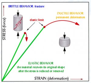
Ductile Deformed originally bilaterally symmetric fossils.

deformation.jpg

Digital+restoration+of+single+deformed+trilobite.jpg

Ductile deformation, meaning that extreme pressures caused by plate tectonics, but not so extreme that the fossils would be obliterated, but rather they deform under ductile conditions, like play-doh. But the pressure can't be too great, or the fossil would reach a brittle failure and snap into pieces.

And there's more, I could go on for days. But the point is that, all of these things make perfect sense if the past was just like today.

In today's world, sea level changes. Simple. Animals make foot tracks and nests and burrows. Ok, simple.

Rivers make meanders. Ok simple.

Flood waters make flood deposits and erosional rills and surfaces (yes, we can see evidence of flooding when it happens).

Global climate does change. I know it's controversial in today's political climate, but it's a real thing. Glaciers advance and they retreat, it's what they do. They deposit till and drop stones. Simple.

Angular unconformity? Simple. Layer A deposits. Layer A lithified. Layer A is tilted by orogenesis, plate tectonics. The himilayas grow in height each year, today. We see it happening, simple.

Layer A is pushed over and erodes flat. Layer B is deposited on top, layer B lithified. Here comes the catch, more orogenesis, the unconformity turns over again making the older and superpositionally deeper layer flat.

1. ______________
(First layer is deposited)

2. // ////// /// //////
// /// // / //// /////// //
(Layer lithifies then turns on side)

3. // /// // / //// /////// //
(Top layer erodes off)

4. __________________
// /// // / //// /////// //
(New layer is deposited on top)

5. ______///////////
______////////////
(New layer lithifies, then the collective system turns again putting the older layers back to horizontal with the younger layers vertical).

Just take time to wrap your head around the above text. And ponder it, in addition to the other details and consider how a flood could do it all.

4 million independent varves in the green River formation. Embrace that number for just a moment.


Then turn back to the question. Could a wave washing across North America do all this?

Most scientists, and by most, I mean every scientist I've ever known, including myself, would say...no.

@Wolseley
 
Last edited:
Upvote 0