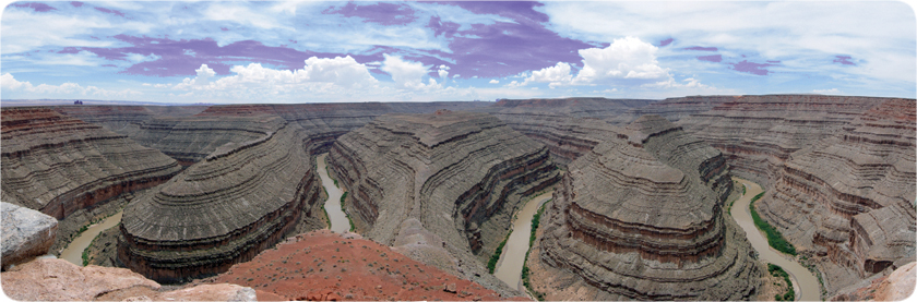
The river would continue to erode through rocks directly below it, until it reached an equilibrium with the underlying groundwater. Which means that, after eroding upperlying sediment (where it had taken shape and meandered) and other cenozoic and upperlying rock, once it reached the mesozoic layers, it would have simply kept eroding in the shape of itself that it had taken at a prior time.
Just as when erosion continued beyond mesozoic layers into paleozoic layers, it maintains its shape because the mesozoic layers guide it into the paleozoic layers.
In some cases, where there is a fault, as you noted, the river might change its shape to some extent. But where there are undisturbed, laterally continuous layers, the river stays as it is.
Also, it should be noted that it is not the river that laterally erodes layers for hundreds of miles. Lateral continuity and original horizontality are just features of pre existing rock. Gravity and erosional forces of wind, water and ice, draw landforms to be laterally continious and horizontal.
To understand how rock layers are dated, i would recommend learning about relative dating methods. Understanding things like superposition, cross cutting relations, inclusions, original horizontality, faunal succession and lateral continuity. Once these are understood, then we could begin talking about the ages of layers.
Relative dating - Wikipedia