- Feb 5, 2002
- 166,671
- 56,280
- Country
- United States
- Faith
- Catholic
- Marital Status
- Married
- Politics
- US-Others
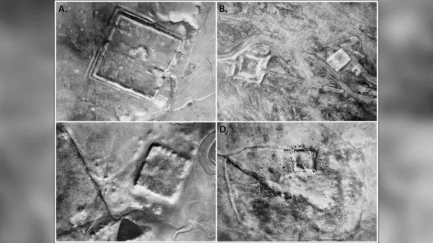
Declassified photos captured by United States spy satellites launched during the Cold War have revealed an archaeological treasure trove: hundreds of previously unknown Roman-era forts.
Corona and Hexagon were two satellite surveillance programs meant to support the Carter Doctrine of US dominance of the Middle and Near East, but now archaeologists are using their declassified aerial photos of landscapes long lost to map the presence and nature of the eastern border of the Roman Empire.
The research team from the Department of Anthropology, Dartmouth College, poured over the photographs and compared them to a map produced in 1934 by a Jesuit missionary named Father Antoine Poidebard, who was also an archaeologist.
Continued below.
 www.goodnewsnetwork.org
Corona and Hexagon were two satellite surveillance programs meant to support the Carter Doctrine of US dominance of the Middle and Near East, but now archaeologists are using their declassified aerial photos of landscapes long lost to map the presence and nature of the eastern border of the Roman Empire.
The research team from the Department of Anthropology, Dartmouth College, poured over the photographs and compared them to a map produced in 1934 by a Jesuit missionary named Father Antoine Poidebard, who was also an archaeologist.
Continued below.
Spy Satellite Photos Reveal Hundreds of Long-Lost Roman Forts, Challenging Decades-Old Theory
Declassified photos captured by United States spy satellites launched during the Cold War have revealed an archaeological treasure trove: hundreds of previously unknown Roman-era forts. Corona and Hexagon were two satellite surveillance programs meant to support the Carter Doctrine of US...
