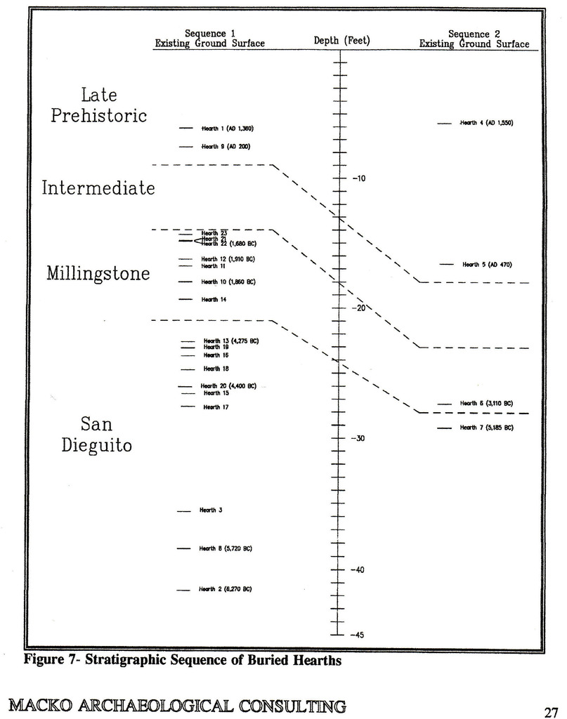
The first graph showed the depth at discovery of a series of prehistoric camps recovered from two trenches excavated for a highway. This photo is what was left after a bulldozer rolls over a fire pit. We actually salvaged a lot of data even
from this one.
Here is another graph to put those data in a regional context.
Each little square represents an archaeological site. Variations in vegetation, and cultural technologies are evident in the variation in archaeological site density for different habitats. It is interesting that following a drought about 3100 years ago, there is a long term shift in vegetation, and population density. There was also a change in technology. The Late Prehistoric people from ~ 1200 years ago to the Spanish invasion in the late 1700s used bow and arrow, and extensively harvested acorns for their main starch.
You will also have noticed that there was no "flood."