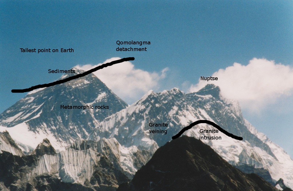
As it says in the wiki article the Marine sediments that accumulated within the continental shelf of India prior to the collision with Asia. So those sediments on the
Qomolangma and North Col formations are the marine sediments and they have been pushed up to the top of Mt Everest. So if those sediments are still on the mountain after 60 million years how deep do you think the sediment layers were. Considering that they reckon the mountain has been eroded down quite a way you would think they had to be pretty thick. What would be the thickest sediment layers around to still allow some sediment to be up there on the mountain. I understand that the sediments are not the surface sediments anymore and have been eroded down a bit. But surely after 60 million years it would have eroded them completely away.
The article says that Everest would completely erode away in 88,480 million years at the minimum rate of erosion of 0.1mms per year.
Geologists have studied rates of erosion in the Himalaya (see this paper, for example) and even low rates of erosion are around 0.1 millimeters per year (mm/yr).
So in 60 million years how much of Everest would have eroded away. If the mountain is 8,848 meters high it should lose over 1/2 even if we allow for variations. So thats about 5,000 meters eroded away off the top of the original mountain that was raised up in the air. So would the sediment layer take up a bit over half the mountain. Thats also allowing for the continued uplift of the mountain which doesn't make any difference to what is lost from the original mountain. Maybe there is another aspect to erosion that I'm not getting, but on face value I cant see how any sediments should be left.