Does the Eocene-Oligocene Transition show Life after the Global Flood?

Job 33:6

Well-Known Member
Jun 15, 2017
7,216
2,786
Hartford, Connecticut
✟292,947.00
Country
United States
Faith
Christian
Marital Status
Married
Politics
US-Republican
Interesting characterization. Yes, this was my original interpretation. The layers were cut uniformly by a rapid and extreme force.

Is something that looks like meat run through a slicer what you expect to see over millions of years of a gradually evolving lithosphere?

If the meat slicer cut at an exceptionally slow rate, over a very long time, it would produce, precisely what we see without needing to be...extreme or chaotic.

The point of the meat cutter analogy was to just describe why both dense and less dense layers evenly erode. Its because the force which erodes them, is flush, like a saw blade. Wind doesnt blow underground, and when it blows, it tumbles sediment which impacts structures and wears them away. It is a slow process, but more importantly, it would erode both dense and less dense layers, to an equal elevation.

Again, its not going to blow and erode rock underground because wind and water dont erode underground (except for in the case of chemical dissolution and limestone caves). Glaciers dont move underground, they move flush with the ground.

So dense and less dense layers erode equally flush with the ground in the direct path of the erosive forces.
 
Upvote 0

Job 33:6

Well-Known Member
Jun 15, 2017
7,216
2,786
Hartford, Connecticut
✟292,947.00
Country
United States
Faith
Christian
Marital Status
Married
Politics
US-Republican
And again, someone might ask well...if the water erodes flush with the ground, why is the grand canyon so deep? The answer is because...
293849_7cd408363782c9cd60e8aae5b40eccbd.jpg


In figure D, the land is lifted by compressional forces (hanging wall up, its being squeezed together), then in figure E extentional forces (hanging wall down) pull the leftwards rock back to the left which is why the uplifted strata moves back down a little bit in figure E. With uplift, water gains gravitational potential energy and is separated, vertically separated from the water table/aquifer and is no longer at equilibrium. The river is no longer at its happy place, so its now going to cut down through the uplifted rock, to re-unite with the water table. And so the the land then erodes back down, flush with grade or sea level or wherever the water table (or underlying aquifer) resides.

And if you look at a groundwater map of the grand canyon, you will see that the river stops eroding as soon as it gets back to its happy place in the underlying aquifer.
 
Upvote 0

Job 33:6

Well-Known Member
Jun 15, 2017
7,216
2,786
Hartford, Connecticut
✟292,947.00
Country
United States
Faith
Christian
Marital Status
Married
Politics
US-Republican
c-sect-legend-688.jpg


And actually, you do get erosion of strata in many areas where the river has become mobile along fault planes. But again, the water is finding its preferential pathways and its cutting back down until it reaches an equilibrium.
 
Upvote 0

Job 33:6

Well-Known Member
Jun 15, 2017
7,216
2,786
Hartford, Connecticut
✟292,947.00
Country
United States
Faith
Christian
Marital Status
Married
Politics
US-Republican
Also, regarding erosion, earlier i talked a bit about wind erosion and sediment tumbling along the ground. Sediment can only be lifted so high off the ground by wind, just because sediment has mass and weight and wind isnt always strong enough to lift it into the sky.

5072420.jpg


This is an example of what i am talking about above. Wind slowly tumbling particles along the ground for a really long time, slowly breaking down material at a particular elevation. It doesnt matter if the rock is super hard, it doesnt matter if it is less hard. Either way, the larger rock mass is going to drop down to grade, then its eventually just going to be broken down into sand and its going to blow over into a sand dune, even at grade, given enough time.

Again, nothing chaotic about this. Its just...ya know, its just regular everyday erosion.

and its observable too. Anyone can go out to a desert, and can just feel sand particles spraying in their face whenever wind blows through. Those particles, they...little by little, impact objects that stick up above grade, and they slowly break them down. And thats just the way it is. It doesnt need to be wild and crazy, everything erodes to a flat desert eventually (at least in a dry area with wind).
 
Last edited:
Upvote 0

Colter

Member
Nov 9, 2004
8,711
1,406
60
✟92,791.00
Faith
Other Religion
Marital Status
Married
Does the Eocene-Oligocene Transition mark the end of the global flood?

In the Genesis flood model, the geologic record (at least of the Phanerozoic) are the remains of a catastrophic global flood and associated tectonic upheaval, followed by an extended period of aftershocks or regional catastrophes as the waters receded from the continents and life began to repopulate a gradually stabilizing earth.

Paleozoic, Mesozoic, and lower Paleogene rock layers are globally catastrophic depositions, or the mass annihilation of the pre-Flood world's ecosystems.

It is at the Eocene-Oligocene Boundary, or EOB, (at about 34 million years ago in the Evolution model) where we see a shift from past global catastrophe to an unfolding of what are now "modern" ecosystems. This phenomena may record the earth being repopulated by land animals migrating from the Ark, as well as the continents becoming seeded with vegetation and other small organisms drifting along ocean currents.

At this boundary, we find a major trend of new types of animals filling out Asia and Europe with a pronounced mammalian faunal replacement..

These patterns are so dominant that researchers have given them names like the "Asian Biotic Reorganization" in Asia and simultaneously, the "Grand Coupure" in Europe.

Eocene–Oligocene extinction event - Wikipedia

"Evidence in the world’s ocean current system indicates an abrupt cooling from 34.1 to 33.6 Ma across the Eocene–Oligocene boundary at 33.9 Ma. The remarkable cooling period in the ocean is correlated with pronounced mammalian faunal replacement within continental Asia as well. The Asian biotic reorganization events are comparable to the Grande Coupure in Europe and the Mongolian Remodeling of mammalian communities. The global cooling is also correlated with marked drying conditions in low-latitudes Asia."

Some other notes from the secular literature:

From "The Eocene-Oligocene Transition" by Coxall and Pearson 2007

"It is interesting that in groups as diverse as foramnifera, primates, whales, and birds, the Oligocene saw the diversification of recognizably modern taxa,whereas most of the Eocene forms are from prehistoric now-extinct groups.....The whole Earth system seems to have entered a period of prolonged change, a factor that makes the Eocene-Oligocene boundary extinctions rather different from the more sudden mass extinctions at the end of the Cretaceous and probably the end of the Permian as well."

"The weight of fossil and climate evidence strongly indicates the Late Eocene to Early Oligocene as a time of major global climate change, with many implications for marine and terrestrial ecosystems... Unlike the Cretaceous-Paleogene or Permian-Triassic boundaries, there is no indication of a sudden catastrophic event: rather, fossil records document a pattern of enhanced yet gradual turn-over, signalling adjustment to changes in food and nutrient availability, habitat, and climate-regime.
"

Some other papers:

"Faunal Turnovers of Paleogene Mammals from Mongolian Plateau" - Meng 1998
"Eocene-Oligocene Transition in Central Asia and its Effects on Mammalian Evolution" Kraatz 2016
"Synchronous Turnover of Flora, Fauna, and Climate at the Eocene-Oligocene Boundary in Asia" - Sun 2014


The last article notes a "remarkable" change in pollen and abrupt increase in grasslands as the climate gets cooler and drier....

We find open grasslands appearing all over the world.

As well as:
- Large-scale aridification or drying
- Significant drop in sea-level
- Major reorganization of the ocean currents


These are all trends we would expect to see around the same time that the "modern" land animals are appearing on the scene as they migrate across a post-flood world.

So that's the idea.

A question arises, why don't we also see pre-flood versions of these "modern" ecosystems that were deposited by the flood before this post-flood transition began to take place?

The flood would have overtaken ecosystems in a basic step-wise fasion.. starting at the deep ocean floors (but not necessarily the open ocean swimmers or inland seas), and working its way up coastlines, and swampy wetlands, and finally the drier uplands where we find much of these same types of ecosystems today. These ecosystems would have been deposited in the upper most rock layers. It is then hypothesized that much of these top layers were then scrubbed off the continents when the global floodwaters began to recede, to be replaced by post-flood sedimentary layers. This is why we don't find an ecosystem of "modern" mammals (or humans) buried in rock layers directly below the post-flood layers where those same types of animals were repopulating the earth.

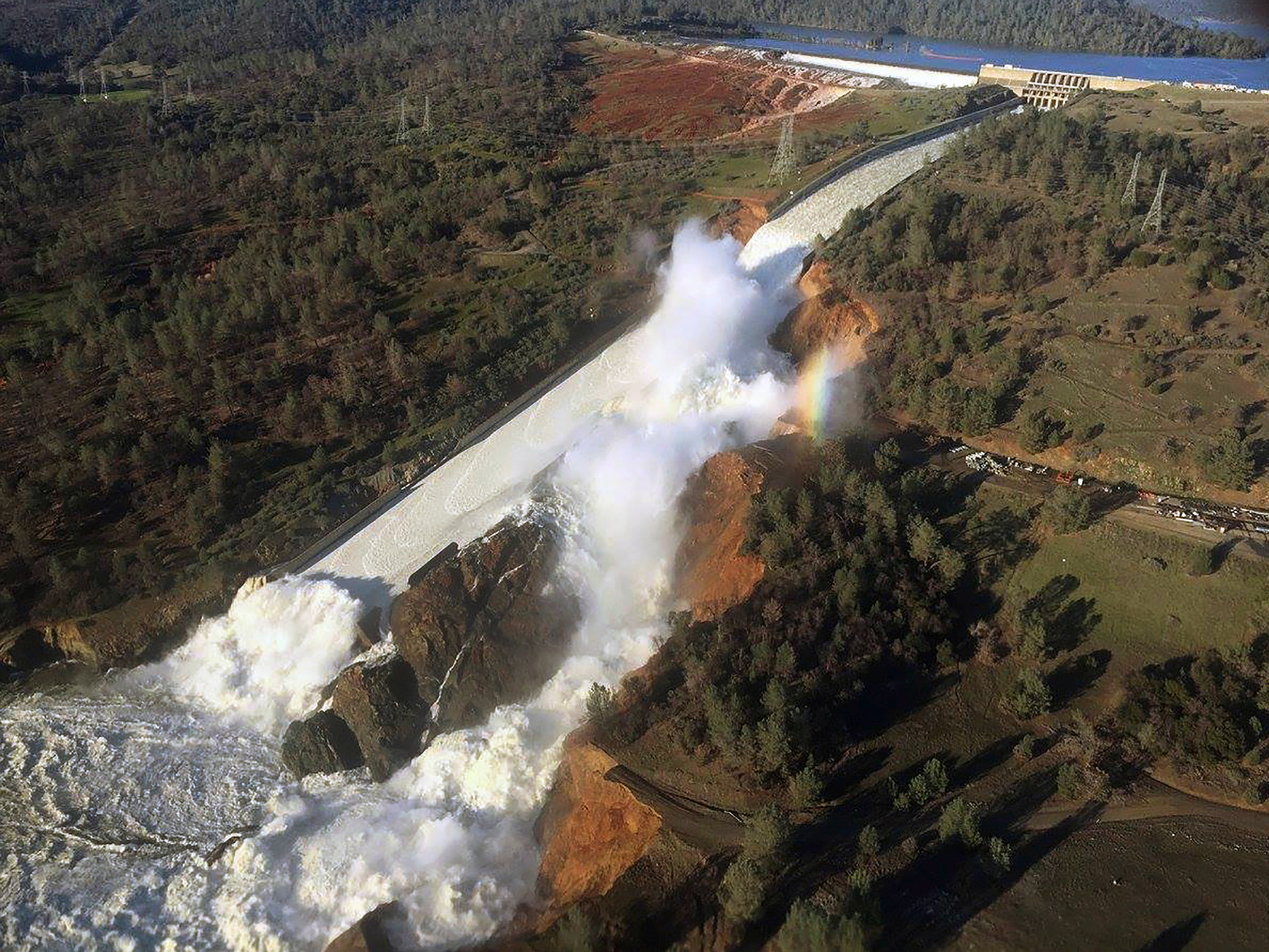
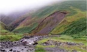
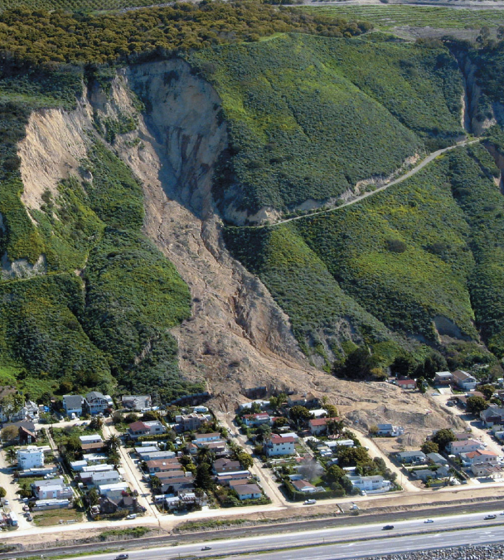
Importantly, as the post-flood world is repopulated, ecosystems still undergo many smaller, regional catastrophes associated with residual tectonic and volcanic activity, as well as regional floods resulting from natural dam-breaks and drainings of in-land lakes or seas that were left over.

Extinct paleozoic and mesozoic land animals would have been included in these post-flood migrations. Any land animal type's absence tells us they were relatively unsuited for the post-flood world, either through predation or other ecological factors, and their populations may have been endangered from the outset. This may be related to the reason they were buried in these lower rock layers to begin with, that these extinct animals lived in far more segregated pre-flood biogeographic realms, and their success levels plummeted in a drastically changed post-flood world.

(Point of clarification: in this flood model we obviously reject the convention of geologic time. Instead, the Paleozoic-Mesozoic layers were deposited in the span of a year-long flood. And the Eocene-Oligocene transition did not actually happen 30+ million years ago, but within the last several thousand years.)


The global flood is a vast exaggeration by the Israelite priest who were attempting to trace their bloodlines back to Adam. Unable to do so they drown the world to fill in the missing people.
 
Upvote 0

lifepsyop

Regular Member
Jan 23, 2014
1,807
405
✟55,859.00
Faith
Christian
Marital Status
Private
https://agupubs.onlinelibrary.wiley.com/doi/full/10.1002/2016JF004099

Here is a paper in which estimates are made for rates of erosion of a fluvial system through sedimentary rocks. These rocks are not impervious shales, nor are they dense quartzites or other dense metamorphic rocks.

The researchers estimate incision rates at 1-3 millimeters per year.

https://pdfs.semanticscholar.org/3199/e10bd3d2df41c1c52245f3c54b24d5b0f8a1.pdf

Here is a paper that suggests rates of erosion peaking at 5 millimeters per year.

Needless to say, rivers do not blast through solid rock at any fast rate.


So, if we look at the images below. Mass wasting occurs in a linear path.

Conchitaslump.jpg

Oroville_dam_spillway_2017-02-11.jpg


xoZvyBHTL18L1utnvc35H3BmvPMd5vcfnDVr_zMb0MqwaYUI0c2pqKRpImsEZL4SLHho0KHJ4PuZK0KWHqnHCMsX20lyj7t8shLPMbIE9Vm6JK75dMXJ2nSyZP9W14Xg7SRsUdPgcvfTJy-sIcf2sGiOBuBgF4FF_Im3MA=w1200-h630-p-k-no-nu

1237.jpg


Notice in the above images, mass wasting is high energy and occurs in a linear path.
===================================================
Below we have low energy meanders.
grandcanyon-goosenecks_meandering_river.jpg

images

170703-20.jpg

In the picture above, we have a non linear, meandering path of a river. These rivers are low energy and sort of...aimlessly wander.They dont have enough energy to force a direct path of motion through rock, so they pick up small sediment, drop it off on a point bar, and cut the opposing wall creating a meander. This is what regular everyday rivers do, its well understood. And if you dont know what a meander is, read about it.
Meander - Wikipedia

This is not high energy, as it bows and ebbs aimlessly twists. High energy would blast in a single direction (as observed in the mass wasting images above), it would not alternate back and forth over and over again.

So we know this is low energy flow. As a matter of fact, we see many low energy rivers forming meanders today, so there is nothing odd about this concept. Casual rivers meander, its just what they do.

Now back to the start, if we have...lets say 6000 feet of rock, and said rock is eroded at an average rate of 5mm per year...

thats 1.8 million millimeters, divided by 5 per year....thats, 360,000 years.

Even if we quadrupled estimates, at 20 mm per year, we would still have 90,000 years.

in order for 6000 feet of rock to be eroded in a single year, we would need an erosion rate, literally 360,000 times greater than rates of erosion observed today.

Unless of course, the river was made of some sort of acid. But then still a river of acid would not meander, it would just burn a linear path.

And again, we know that these rocks were solidified prior to erosion, as non solidified rocks would not contain things like fault gouge and fault skarp, sharp brecciated fragmentation, propagating faults, sheared fossils and minerals and things of the like.

Sorry for the delayed response. I forgot how time-consuming these discussions can be.

Let's deal with your whole river argument, which is a good one I might add. For a second you had me fooled into believing the flood model excludes river formation which I don't see any reason for.

If this pre-canyon region were temporarily drained (either through a tidal drop in sea-level or tectonic uplift) and then took on a little water for a short period (say through a relatively small dam burst, or some result of the water run-off), then this would introduce the meandering river pattern.. because it would be a river.


oc1.jpg


In experiments you can see how moving water begins rapidly seeking out those S-curves in sediment.


mr1.jpg


After this relatively low-energy meandering pathway is cut into the ground, a large amount of water is introduced, either in progressive stages or all at once, and either from rising sea-level, tectonic activity, or a massive dam failure, and this large amount of water amplifies the existing river morphology.

Actually in this fast-forward animation of the evolutionary model, the canyon formation has a very natural look to it, as if you're seeing water do it in real time.

gc1.jpg


Here's a fluid dynamics video showing the formation of small submarine canyons.

subc1.jpg


Compare those rapid sediment carving patterns with the grand canyon animation around 55 seconds or so.

gc1.jpg


Now I'm not saying that submarine experiment is exactly what happened here, I'm just giving the reader an idea, something to think about.

The flood model better explains both the river formation and the incredibly massive earth scouring that has taken place. The "little meandering river over millions of years" hypothesis just intuitively feels awkward.

Does this really look like the result of a meandering river over millions of years?


gc-nrim-bright-angel-point-1_elisabethkwak_680.jpg


Or does it look like something massively catastrophic occurred around a pre-existing river formation?

99556161-1DD8-B71B-0B896E4D786C6B47.jpg
 
Last edited:
Upvote 0

Job 33:6

Well-Known Member
Jun 15, 2017
7,216
2,786
Hartford, Connecticut
✟292,947.00
Country
United States
Faith
Christian
Marital Status
Married
Politics
US-Republican
The above doesn't explain how 10,000 plus feet of rock was eroded in a single year. By said river, that is.

As I pointed out before with a couple research estimates of erosion rates, erosion by rivers, even when excelled by incision during uplift, really only amounts to perhaps 5 mm per year in sedimentary rocks.

To suggest that several thousand feet were eroded by such a river in a single year, really doesn't make any sense.

I feel like I've said this already though.
 
Last edited:
Upvote 0

Job 33:6

Well-Known Member
Jun 15, 2017
7,216
2,786
Hartford, Connecticut
✟292,947.00
Country
United States
Faith
Christian
Marital Status
Married
Politics
US-Republican
Really,

There are many things that you aren't or haven't responded to.

You seemed to struggle with the idea of varying density rocks eroding at an equal level. Now it seems like you're on to another topic.

Take some time to re-read my posts and if you have questions, feel free to ask.

Once you understand the material of one subject, then we can always move on to another.

Do you understand why erosion breaks down rocks of varying density to an equal elevation?
 
Last edited:
Upvote 0
This site stays free and accessible to all because of donations from people like you.
Consider making a one-time or monthly donation. We appreciate your support!
- Dan Doughty and Team Christian Forums

lifepsyop

Regular Member
Jan 23, 2014
1,807
405
✟55,859.00
Faith
Christian
Marital Status
Private
The above doesn't explain how 10,000 plus feet of rock was eroded in a single year. By said river, that is.

As I pointed out before with a couple research estimates of erosion rates, erosion by rivers, even when excelled by incision during uplift, really only amounts to perhaps 5 mm per year in sedimentary rocks.

To suggest that several thousand feet were eroded by such a river in a single year, really doesn't make any sense.

I feel like I've said this already though.

Why do you keep trying to limit everything to a year?

I've stated repeatedly that many geologic features are also the result of post-flood catastrophes - including later dam breakage of leftover inland seas and lakes draining off the continents in progressive stages after the ocean levels had receded.

So now that you've been reminded, hopefully this particular strawman argument doesn't pop up again unless you can actually support it.

Also, the video in which the water was making s curves is in soft sediment, not solid rock. So it isn't analogous to formation of something like the grand canyon.

I didn't say it was analogous. It's simply a demonstration of how rapidly the curving patterns are etched out. So the meandering morphology itself is not evidence of long ages. That's all.

Also, I wouldn't necessarily assume the sediment was fully hardened at the time.

Show me a demonstration of water introducing meanders in solid rock. (Is this what you're proposing actually took place?) I would be very interested to see that.


You seemed to struggle with the idea of varying density rocks eroding at an equal level.

Why would I struggle with that idea when it's exactly the thing I proposed? That the varying rock layers were sheared off equally by a high level of erosion.

Sure, I'd buy that gradual erosion could do the same thing over millions of years.

I think the difference is that the leveled angular conformity is something a catastrophic flood model actually predicts, whereas in your deep-time model it seems like a convenient accommodation.

Now it seems like you're on to another topic.

You're the one that raised these issues in the first place, and now you're going to play like I'm deflecting to other topics? That's cute. Here's a tip, if you don't want me to respond to something, then don't post it.

And the latter video on submarine canyons is irrelevant because it doesn't say anything about the formation of meanders.

Take your own advice and try reading posts. I was drawing attention to the erosion patterns and channeling on the canyon walls, not the meander.
 
Upvote 0

Job 33:6

Well-Known Member
Jun 15, 2017
7,216
2,786
Hartford, Connecticut
✟292,947.00
Country
United States
Faith
Christian
Marital Status
Married
Politics
US-Republican
"Why do you keep trying to limit everything to a year?"

How long do you think the flood and post flood runoff occurred? Even if it were a thousand years, it still wouldnt nearly be enough.

"Also, I wouldn't necessarily assume the sediment was fully hardened at the time."

Its not an assumption, its physics. You cant have things like sheared minerals in anything less than solid rock, it physically is impossible. You cant have things like perpendicular propogating faults in soft sediment. Among many other features we find superpositionally prior to uplift and erosion of the layers above.

"Show me a demonstration of water introducing meanders in solid rock."


The meanders do not need to be introduced into solid rock, they can form as all meanders do in regular soil. It is erosion through rock, after uplift that I am saying cannot be explained in your post. Nowhere in your prior post did you explain how it is that thousands of feet of rock were eroded in a year, or even in a hundred years or even in a thousand.

"Sure, I'd buy that gradual erosion could do the same thing over millions of years."


Ok, thank you.

"Take your own advice and try reading posts. I was drawing attention to the erosion patterns and channeling on the canyon walls, not the meander."

Thats right, not the meander. Exactly. So your videos do not support the discussion of how thousands of feet of rock would be eroded in any short period of time by water moving through a meander.
 
  • Like
Reactions: Ophiolite
Upvote 0

Job 33:6

Well-Known Member
Jun 15, 2017
7,216
2,786
Hartford, Connecticut
✟292,947.00
Country
United States
Faith
Christian
Marital Status
Married
Politics
US-Republican
"Its not an assumption, its physics. You cant have things like sheared minerals in anything less than solid rock, it physically is impossible. You cant have things like perpendicular propogating faults in soft sediment. Among many other features we find superpositionally prior to uplift and erosion of the layers above."

To elaborate on this, lets take perpindicular propogating faults for example...

fractures occur in uniform splits between bodies of solid material. You couldnt fracture a ball of sand for example, because sand grains would not split by force. Rather they would just sort of roll off of one another. Because they arent fused together in any way.

Like, with play doh, or anything soft, you cant smash soft material and have perpindicular propogating splits in play doh.


"I think the difference is that the leveled angular conformity is something a catastrophic flood model actually predicts"

Also, i mentioned another example before with the overturned unconformity.

Its not an angular conformity, its called an angular unconformity. There is no such thing as an angular conformity.

You keep saying things that make absolutely no sense, or have small textual errors in them, which suggest that you probably aren't familiar with the material enough so to cast correct judgement.

But regarding the overturned angular unconformity that i had described in earlier posts, you cant get 90 degree rotation of a laterally continuous body of soft sediment with things like fault gouge and another subsequent 90 degree turn. You just cant do that, its a physical impossibilty.

And im sorry if you cant seem to accept this, but no geologist would ever suggest such a suggestion because it just doesnt make any sense.

It would be like making a layer of sand on the beach then turning it to a vertical position without obstructing its layering or bending it or twisting it, then chopping off the top and laying another batch of layers horizontally overtop of it. Then having animals make burrow networks inside of it (there are fossils in it), then turning back over on its site and bringing the latter layers to a vertical position.

All of this while maintaining structural integrity of the layers, and in addition to this, you get fault gouge from rocks rubbing against other rocks. You cant rub sand together and get brecciated fault gouge. And beyond that you have lithologic variation between these formations. Which if they were soft sediment, you would think there would be some mixing of lithology.


None of it makes any sense if it were all soft or even semi soft sediment, and no credible scientist would ever suggest such a bizarre explanation for such a structure, for the reasons listed above.
 
Last edited:
  • Agree
Reactions: Ophiolite
Upvote 0

Job 33:6

Well-Known Member
Jun 15, 2017
7,216
2,786
Hartford, Connecticut
✟292,947.00
Country
United States
Faith
Christian
Marital Status
Married
Politics
US-Republican
Regarding the rivers meanders, Ill elaborate.

293849_7cd408363782c9cd60e8aae5b40eccbd.jpg


Figure A: Several layers are deposited of varying lithology.

Figure B: There is extentional faulting, the land is essentially stretched and pulled apart, the layers dip down into the void produced by extentional faulting.

Unkar group description below:
"

Unconformities[edit]
The base of the Unkar Group is a major unconformity that also forms the base of the Grand Canyon Supergroup. This unconformity is a nonconformity that separates the underlying and deeply eroded crystalline basement, which consists of granites, gneisses, pegmatites, and schists of the Vishnu Basement Rocks, from stratified Proterozoic rocks of the Unkar Group.[6] T

The Vishnu Basement Rocks underlying this surface are often deeply weathered to an average depth of 3 m (9.8 ft) below it. Where it has not been removed by erosion prior to and during the deposition of the overlying Bass Formation, a residual regolith – developed by subaerial weathering of the underlying basement rocks – is present. Typically, this regolith consists of dark-reddish brown, structureless, ferrigenous sediment that is usually a few centimeters to 30 cm (0.98 ft) thick. This contact is regarded to be a classic example of an ancient peneplain.[13]

The contact between the Tonto Group and Unkar Group is a prominent angular unconformity, which is part of the Great Unconformity. The surface of this angular unconformity truncates dipping strata comprising the folded and faulted Unkar Group. Though this surface is typically a plane, differential erosion of the tilted strata of the Unkar Group left resistant beds of the upper layer Cardenas Basalt and the middle layer Shinumo Quartzite as ancient hills, called monadnocks. These ancient hills, which are ridges formed by block faulting, are up to 240 m (790 ft) tall. Thin drapes of Tapeats Sandstone of the Tonto Group either cover or drape onto most of these ancient monadnocks. However, the summits of the highest monadnocks protrude up through the base layer Tapeats Sandstone and are blanketed by overlying Bright Angel Shale as can be seen at Isis Temple. Lava Butte is a partially exhumed prehistoric monadnock associated with this unconformity that consists of Cardenas Basalt. These monadnocks served locally as sources of coarse-grained sediments during the marine transgression that deposited the Tapeats Sandstone (Tapeats Sea), and other members of the Tonto Group.[4][6][7][13]

Within the Unkar Group, the contact between the Hakatai Shale and overlying Shinumo Sandstone is a distinct disconformity. This contact is the only significant unconformity that occurs within the Unkar Group. This disconformity is sharp and locally truncates cross-bedding and channels exhibited by sandstones in the underlying Hakatai Shale. Within the Shinumo Quartzite, a basal lag composed of a layer of conglomerate, which contains basement clasts up to 5 cm (2.0 in) across, lies on the eroded surface that forms this disconformity.


So really, another reason we know this isnt folding of soft sediment is that these rocks form at particular cooling points. You cant get folding and faulting of magma. Its a liquid. So if you see folding and faulting through magmatic rock, its because it is solidified and cooled. We also have things like dikes and sills which propogate to grade and cool at the surface in formation. Beyond that you have transgressive sequences which are worth noting.

So what we have by Figure A is a cooled set of layers which is tilted. Then it is eroded away.

Figure C:

Then we have deposition of our paleozoic and mesozoic strata, in which we have the periods which encompass the overturned angular unconformity which i have described which is present in the northeast region of the US and are described in my signature old earth geology posts and above in this topic. These layers also have more complex burrow networks, dinosaur nests with eggs, wandering tracks of animals walking around etc. And these features are all throughout every single one of these thousands of layers. So, there was time within the paleozoic deposition between each of these layers for animals to live life and to dig burrows and have nests and lay eggs and live life. Between every one of the formations of which there are countless in the mesozoic and paleozoic. We also have various forms of faulting in these layers in this same region, and cooled metamorphic rocks. If triassic strata is laid down, dinosaurs walk and live all over it, then jurassic strata is laid down and dinosaurs live and walk all over it, then cretaceous strata is laid down and dinosaurs live and walk all over it, all of which are predated by prehistoric paleozoic reptiles which lived and walked all over it, and post dated by cenozoic fauna that lived and walked all over it, in between layers...

then we know that life had time to live and to do things between these layers. And clearly the flood wasnt killing them. Because even after deposition of layer after layer after layer, they continued to be present. living, doing what they do.

This is also the time in which rivers are present, and meanders are formed casually, as they are in todays world by every day regular rivers.

But know that the river forms at grade, as rivers do today, above already solidified and hardened and paleozoic and mesozoic rock. Subsurface strata could only be hard for the formation of fractured sills and fault gouge and overturned unconformities, propogating faults etc.

Now,

Figure D:

The land is uplifted by compressional and inward tectonic motion (this is your laramide orogeny), and the river which has meanders through sediment at grade, gains gravitational potential energy and begins incision into rock. And as the land continues to uplift, the river continues to cut through rock.

We know uplift occurs very slowly as continents push against eachother, sort of like how the himilayas are growing today. We know rivers slowly cut through rock and can observe their incision at very slow rates of millimeters per year in todays time.

We can see all of this happening today, so there is nothing bizarre or confusing about it, because we can see it happening.

figure E:

Extentional faulting occurs in a stretching and outward force, pulling the hanging wall/left block back down. The river which is cutting down through rocks of its meanders, erodes the area, through thousands of feet of rock.

And today, in the present time, we have the final product of uplifted land, with a river cutting through meanders, through thousands of feet of rock.

And if you google rates of erosion in the grand canyon, you can still see this happening to this very day.

BotEC: The Grand Canyon's Rate of Erosion

At a rate of erosion, observed and measured at "Answer: 0.402 mm/year".
 
Last edited:
Upvote 0

Job 33:6

Well-Known Member
Jun 15, 2017
7,216
2,786
Hartford, Connecticut
✟292,947.00
Country
United States
Faith
Christian
Marital Status
Married
Politics
US-Republican
Now all of the above makes sense because we can actually physically see it all happening to this very day. We see tectonics pushing mountains up into the atmosphere. We see rivers, slowly eroding.

We see the formation of faults and motion of faults, all over the world, all the time.

We see deposition of fine sediment being buried and slowly lithifying below grade.

We see animals living, walking around, laying eggs, building nests, digging burrows.

Every aspect of the above, is something we see happening today. There really is nothing that doesn't make sense about it because everything is right in front of us to see.


And there is a lot more information and evidence to support all of this and an old earth.

A lot more, way more than i could every really be bothered to expound on in an internet forum.

-----------------------------------------------------------------
Simultaneously, we look at the alternative of a young earth. Here we see physics and chemistry being defied at every turn. We cant talk about young earth ideas for 5 seconds without something not making sense or without invoking acid waters which erode away thousands of feet of rock in brief periods of time...or animals finding random islands in the midst of an apocolypse and building nests and laying eggs and digging complex burrow networks, as if life was going on casually. Propogating faults which allegedly form in soft or semi soft sediment (which doesnt make any sense) or...shearing of trilobites in synchronization with rock, somehow also occuring in soft or semisoft sediment...which doesnt make any sense.

It all defies physics and chemistry from the very beginning to the very end. Because you cant shear objects that are not fused or lithified together, nor can you create propogating fractures in objects that are not solid. It just doesnt make any sense.

And if there were really flood waters that engulfed the whole world, except for the tallest mountains, then terrestrial life and nests and burrows and tracks...should not be found in every geologic period (post devonian of course), all around the globe. It is blatently obvious that all life, lived, and prospered all throughout all of these layers, all over the world. There was no instantaneous single extinction of life. There were 5 mega extinctions, but even these, before and after, life prospered within strata. For example, we have our k-t boundary and iridium layer and the yucatan impact crater with shocked quartz and all that good stuff. Yes, the dinosaurs didnt live after the superpositional location of the iridium layer, but life still prospered before and after this layer, as with the other extiction layers. And if it wasn't the flood that killed the dinosaurs, but rather was an asteroid, you would think there would something in scripture about this.

And none of this makes any sense from a young earth perspective. But it all makes perfect sense from an old earth perspective.
 
Last edited:
Upvote 0
This site stays free and accessible to all because of donations from people like you.
Consider making a one-time or monthly donation. We appreciate your support!
- Dan Doughty and Team Christian Forums

Job 33:6

Well-Known Member
Jun 15, 2017
7,216
2,786
Hartford, Connecticut
✟292,947.00
Country
United States
Faith
Christian
Marital Status
Married
Politics
US-Republican
@lifepsyop

I will give you the last word.

If you have questions, you can ask me. But ultimately, your suggestions defy physics and chemistry. If you aren't willing to accept this, then thats kind of on you. There isnt really anything that I, or anyone else could every say that would change your mind if you cant accept this.

And im not here to debate, because there isnt anything to debate. I'd be happy to inform people of geology, but the debate was settled hundreds of years ago. The only geologists who are flood believers today...are a fringe few who are deeply gripping to their religious background. Meanwhile, there are millions of old earth geologists (or just regular geologists as we know ourselves to be) who are simply going on about our business without entering the discussion with pre-conceived information from a source that isn't a form of geologic evidence (scripture).

And, i think there is honor in...trusting in the Lord and supporting His word and His message. Those few flood believers, just seem to have gone a bit too far, just as some other fringe Christian groups have gone just a bit too far off the psychological deep end.
 
Last edited:
  • Like
Reactions: Ophiolite
Upvote 0

lifepsyop

Regular Member
Jan 23, 2014
1,807
405
✟55,859.00
Faith
Christian
Marital Status
Private
@lifepsyop
If you have questions, you can ask me. But ultimately, your suggestions defy physics and chemistry. If you aren't willing to accept this, then thats kind of on you.

It is clear to me that you want the earth to be old, rather than being truly convinced by the evidence. Why else would you be so strangely convicted by ambiguities?


And im not here to debate, because there isnt anything to debate. I'd be happy to inform people of geology, but the debate was settled hundreds of years ago. The only geologists who are flood believers today...are a fringe few who are deeply gripping to their religious background.
Meanwhile, there are millions of old earth geologists (or just regular geologists as we know ourselves to be) who are simply going on about our business without entering the discussion with pre-conceived information from a source that isn't a form of geologic evidence (scripture).

Really? Being told over and over again from childhood that the world is billions of years old doesn't count as a pre-conceived notion? That is truly a ridiculous claim that does not make you look objective at all.

And, i think there is honor in...trusting in the Lord and supporting His word and His message. Those few flood believers, just seem to have gone a bit too far, just as some other fringe Christian groups have gone just a bit too far off the psychological deep end.

They did eat, they drank, they married wives, they were given in marriage, until the day that Noe entered into the ark, and the flood came, and destroyed them all. - Luke 17:27

0531fyp.jpg

 
Upvote 0

Speedwell

Well-Known Member
May 11, 2016
23,928
17,625
81
St Charles, IL
✟347,270.00
Country
United States
Faith
Other Religion
Marital Status
Married
They did eat, they drank, they married wives, they were given in marriage, until the day that Noe entered into the ark, and the flood came, and destroyed them all. - Luke 17:27
So faith in Christ will not save you unless you believe in a literal Genesis too?
0531fyp.jpg
 
Upvote 0

Job 33:6

Well-Known Member
Jun 15, 2017
7,216
2,786
Hartford, Connecticut
✟292,947.00
Country
United States
Faith
Christian
Marital Status
Married
Politics
US-Republican
It is clear to me that you want the earth to be old, rather than being truly convinced by the evidence. Why else would you be so strangely convicted by ambiguities?


Really? Being told over and over again from childhood that the world is billions of years old doesn't count as a pre-conceived notion? That is truly a ridiculous claim that does not make you look objective at all.


They did eat, they drank, they married wives, they were given in marriage, until the day that Noe entered into the ark, and the flood came, and destroyed them all. - Luke 17:27

0531fyp.jpg

Again, no technical response in the above statement.
 
  • Agree
Reactions: USincognito
Upvote 0
This site stays free and accessible to all because of donations from people like you.
Consider making a one-time or monthly donation. We appreciate your support!
- Dan Doughty and Team Christian Forums

lifepsyop

Regular Member
Jan 23, 2014
1,807
405
✟55,859.00
Faith
Christian
Marital Status
Private
Again, no technical response in the above statement.

Sorry, I'm not much on responding to bald assertions that flood geology "defies physics and chemistry"

... You've laid out plenty of data, but have been very light on actual support of your arguments (e.g. animals couldn't have possibly burrowed at any stage during the flood because........ ? )

Your seemingly most critical attack, that the grand canyon could not possibly have been carved within hundreds of years, you didn't even support at all as far as I can tell. And the more you insist that you're an authority on these matters, the less I think you actually are.

However, I made a Grand Canyon thread, you can discuss here if you want. I'd be glad to hear your take on things. You are a challenging debater and I like that.

Debunking 'millions of years' - Grand Canyon Geology
 
Upvote 0