You are using an out of date browser. It may not display this or other websites correctly.
You should upgrade or use an alternative browser.
You should upgrade or use an alternative browser.
Photos
- Thread starter Epoh99
- Start date
LoisGriffin
I am not a sheep! I follow only one!
Its fairly recent according to our guide. I cant remember the exact date but it was after the year 2000.
If I remember correctly the outer part represents the world and the inner part represents God.
There was so much amazing artwork in the Vatican I found it quite overwhelming.
Trevi Fountain is so beautiful. When we went in the daytime a big storm was just starting and gave it a great atmosphere (even though we got so wet!). We had two big storms and they kinda went perfectly with where we were at the time.
Upvote
0
127.0.0.1
They rally 'round the family
GEOLOGY 120 Field Trip was today. Lots of fun and excitement. Fortunately millions and millions of years have already passed so we didn't have to wait very long for all the neat rock formations to form. Wish I'd taken more pictures.
See if you can guess where we are. Maybe something a little more accurate than just, USA") .
.
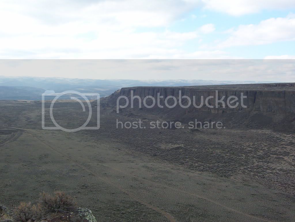
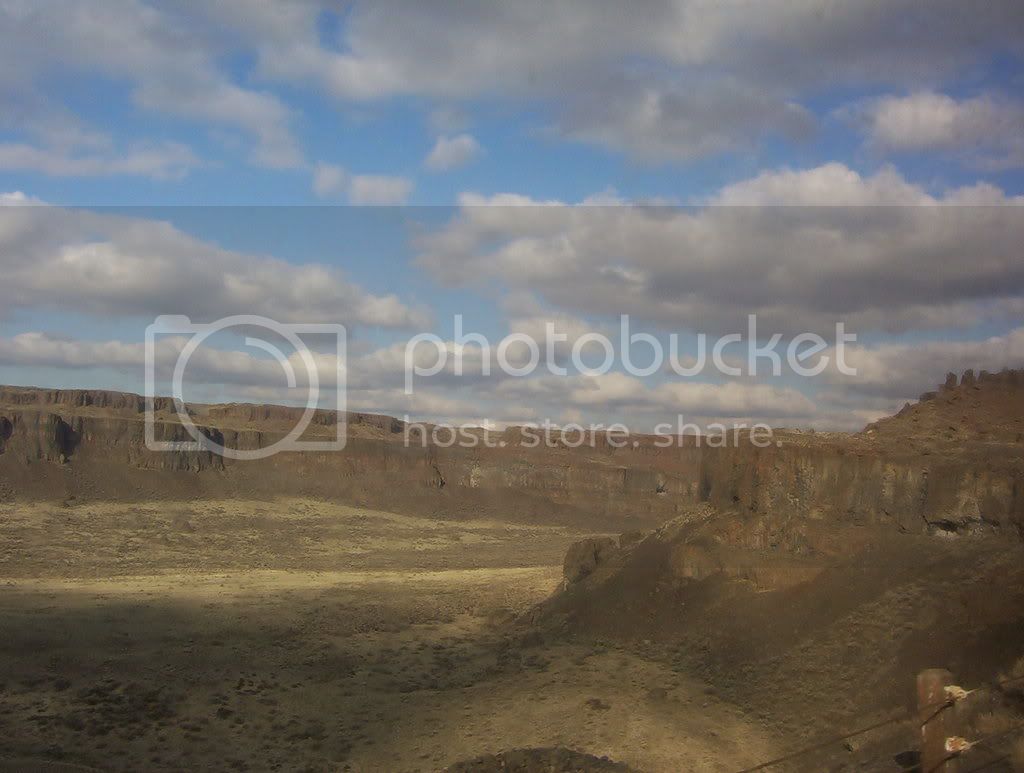
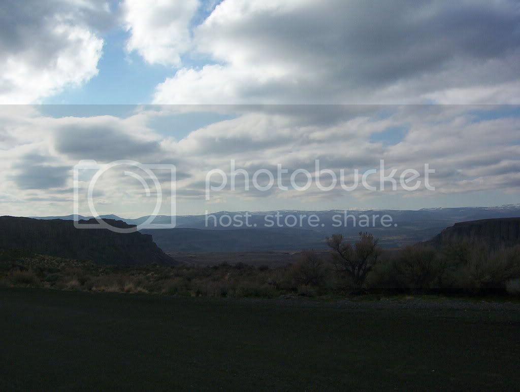
See if you can guess where we are. Maybe something a little more accurate than just, USA
.
Upvote
0
snoochface
Meet the new boss -- same as the old boss.
- Jan 3, 2005
- 14,124
- 2,968
- 57
- Faith
- Non-Denom
- Marital Status
- Married
- Politics
- US-Libertarian
If I had to guess, I'd say Utah or Montana?
Upvote
0
127.0.0.1
They rally 'round the family
No way I'm I going to just hand this to ya! It's too much fun to make you put your thinking cap on.
I'll give you a hint. The first picture is probably the best, for determining where we are.
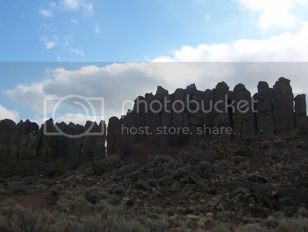
Look at that canyon. What's it made of? What type of rock is it (the rock in the 2nd pic is of the same type, so look at that)?
I'll give you a hint. The first picture is probably the best, for determining where we are.
Look at that canyon. What's it made of? What type of rock is it (the rock in the 2nd pic is of the same type, so look at that)?
Upvote
0
LoisGriffin
I am not a sheep! I follow only one!
Love the scenery but have no clue as to where abouts it is.
Upvote
0
snoochface
Meet the new boss -- same as the old boss.
- Jan 3, 2005
- 14,124
- 2,968
- 57
- Faith
- Non-Denom
- Marital Status
- Married
- Politics
- US-Libertarian
LOL I have no idea. It looks like the southwest to me -- maybe Arizona or New Mexico? Which isn't very similar to my first choices of Utah or Montana, I know.
Have I ever mentioned that I'm horrible at earth sciences and geography?
Have I ever mentioned that I'm horrible at earth sciences and geography?
Upvote
0
It reminds me of AZ....also kind of similar to New Mexico. Maybe Colorado? I've never been to CO. I am also horrible at anything to do with geography, geology, history, anything like that.
Upvote
0
127.0.0.1
They rally 'round the family
A little history.
A long, long time ago, before Darth Vader was ever born 'n all that, what you're looking at used to be a lush green environment. Not only was this environment once green it was humid, very humid. In fact it used to be similar to what you'd find in Mississippi or Louisiana.
Then came a lava flow, which blanketed everything and cooled into basalt. This was followed by a time of peace (how long is unknown) then the process repeated.
So when looking at the cliff faces you see numerous layers of basalt, each from a different eruption. The lush green environment was usually able to return to the are after an eruption, up until a certain point. The eruptions fueled the expansion of a particular mountain range which eventually grew high enough to block most of the rain clouds, thus drastically reducing the amount of rainfall the area got and eventually it became the arid climate of sage brush you see now, with rolling hills of mile high basalt layers.
We know it used to be a lush green environment because trees which had fallen into a swamp, which was full of Vantage Sandstone, were protected from the extreme heat of the lava and were preserved in the basalt rock. In the Basalt rock, the trees are preserved from oxidization and then ground water seeps in. The ground water which seeped in was very silica rich from the basalts. Even though basalt rock is not very silica rich in and of itself, in this case there was just so much of it, that it all added up. Then as the groundwater dissolved the trees, the silica (Quartz crystal) faithfully replaced the cell structure of the wood. Thus creating petrified wood. So the fossilized wood you see is actually Silica Quartz, and not the actual wood at all.
Something else' about this place, had geologist confused for a long time. In this region, it isn't too uncommon to be walking along flat ground when, for some strange reason, there's a bolder there (some the size of small buildings). Not only does this place have random, huge boulders scattered about, some of them aren't even native to the area. Geologists spend a long time trying to figure out how these basalt flats have random boulders, some of which appear to have come from as far away as Canada and Montana, lying around. Seemingly, randomly discarded.
It was proposed that a massive flood occurred during the ice age, not once, but numerous times. Cutting through the basalt rock and carrying boulders the size of houses. Supposedly the flood contained more water that all the fresh water springs in the world. In this region, one can see canyons all over the place, for miles and miles around. The flood is believed to have travel at 65mph and could be heard about half an hour before it's arrival. Look at the photos and just imagine an enourmus wall of water, probably even higher than the cliffs themselves, simply tearing through the whole valley.
But it wasn't until Geologists began looking at aerial photos of farmland in Montana that they knew where the flood came from. People had always been familiar with the foothills of Western Montana, 30ft high and 2miles wide, but it wasn't until seen from above that it because obvious what they were looking at, a lake bed.
Put simply, the flood that tore through basalt rock, forming mile wide canyons, carried boulders the size of houses, came from one of the biggest lakes in the world. Lake Mazula, which came from a river that was blocked by the Northern Ice Sheet; it covered the valleys of Western Montana.
With the river backed up, it simply continued to get bigger and bigger until it was nearly 2,000ft deep. When a crack would appear in the ice, the water came gushing out and emptied in as little as 48hr. Then raced through Idaho and into...
Any guesses yet?
Last edited:
Upvote
0
This site stays free and accessible to all because of donations from people like you.
Consider making a one-time or monthly donation. We appreciate your support!
- Dan Doughty and Team Christian Forums
127.0.0.1
They rally 'round the family
Usually when I say, Eastern WA, people think, E. WA= constant rain= lots of evergreens (true in some parts, towards Oregon)= cloudy skies all the time, apparently they've never been there. So now you know, when someone says, E. WA, don't think Seattle drizzle, think Az. or Col.
Now be honest. Would you ever have guessed E. WA? Well now you know, and since everyone thinks WA=rain=forest, you can have hours of fun, making your friends try to guess!
Now be honest. Would you ever have guessed E. WA? Well now you know, and since everyone thinks WA=rain=forest, you can have hours of fun, making your friends try to guess!
Last edited:
Upvote
0
Similar threads
- Replies
- 0
- Views
- 166
- Replies
- 1
- Views
- 339
- Replies
- 0
- Views
- 135
- Replies
- 1
- Views
- 262