How to make the Bible and Science match...a very original view

Gbob

Active Member
Site Supporter
Apr 28, 2019
80
37
74
College Station
✟56,139.00
Country
United States
Faith
Christian
Marital Status
Married
I have spent my life working on whether or not the Bible is true. My dad was an atheist, my mom a sociopathic, Bible quoting person. I had to know which view was correct and just proclaiming Christianity or any religion as true and then never doubting that doesn't seem to be a good procedure. I turned to observational evidence, and insisted that if observation couldn't match the Bible, then the Bible would be false. I spent 15+ years in severre doubt about christianity because of this question. By way of introduction I am a retired geophysicist who looked for oil all over the world.

The Rivers of Eden: Blind chance or Divine Intervention?
by Glenn R. Morton, March 14, 2020

The rivers of Eden describes the Eastern Mediterranean area as it was 5.3 myr ago. It points to Eden being located in the only place on earth that was flooded with a flood that matches the Biblical description of Noah's flood. How did that happen? How is that possible? Below, I show how the Bible does match that time frame. It is up to you to decide how this occurred.

Eden is not popular with our theologians anymore. To me, this is a problem in need of solution because I believe Christian theology requires Eden and the events there to be real historical events. Most modern Christians don't think Eden's geography is real. And they do so for good reason, today's geography makes Eden impossible. Eden is reserved for a special castigation and unbelief by our scholars. John Monday writes:

"Some have gone further and claimed the geographical allusion is to a fantasy. For Cassuto, 'The Garden of Eden according to the Torah was not situated in our world.' Skinner claimed: 'it is obvious that a real locality answering the description of Eden exists and has existed nowhere on the face of the earth...(T)he whole representation (is) outside the sphere of real geographic knowledge. In (Genesis 2) 10-14, in short, we have...a semi-mythical geography.' For Ryle, 'The account...is irreconcilable with scientific geography.' Radday believed that Eden is nowhere because of its deliberately tongue-in-cheek fantastic geography. McKenzie asserted that 'the geography of Eden is altogether unreal; it is a Never-never land.' Amit held the garden story to be literary utopiansim, that the Garden was 'never-known,' with no real location. Burns' similar view is that the rivers were the entryway into the numinous world. An unusual mixture of views was maintained by Wallace, who held that the inclusion of the Tigris and Euphrates indicated an 'earthly geographic situation,' but saw the Eden narrative as constructed from a garden dwelling-of-God motif (with rivers nourishing the earth) combined with a creation motif, both drawing richly from those motifs as found in Ancient Near East mythological literature." John C. Munday, Jr., "Eden's Geography Erodes Flood Geology,"Westminster Theological Journal, 58(1996), pp. 123-154,p.128-130

John Worrall, professor of the philosophy of science at the London School of Economics, said:

"There is an enormous difference between myths like the Garden of Eden -- so crazy even bishops don't believe it -- and those myths which, as yet, have no evidence to back them up. Camelot falls into this category." http://detnews.com/1998/accent/9808/20/08200043.htm Link no longer works but can be found in 1998 in 2 newspapers at Newspapers.com

So, is the geography of Eden real? I hope to show that it was real, and that geography has changed, and the description of Eden no longer fits today. But it is going to stretch the comfort of many.

I remember as a teen hearing a preacher ask his audience of teens, how many wanted to know God's will? Nearly all the hands went up. Then he asked, How many of you are willing to do whatever it is he asks? Most hands went down and a few remained up. The preacher then said, "You are the ones who will find his will for your lives.?".

I think this story also goes for apologetics. Are we willing to go where the data says to go? I think most are not, some go part way and a few might be willing to go all the way. When I was a new christian and was just getting into the creation/evolution area, and sadly becoming a YEC, I knew YEC had problems but felt the theology required a true history from Genesis. I told my best friend of the time,, my roommate and eventual best man, that I was going to solve the CE issue. That was a brash brag on the part of a 19 year old. The flood was what intrigued me most because floods leave evidence of themselves. And there is zero evidence of a big flood in Mesopotamia and the YEC global flood wouldn't work for so many reasons. My search led me eventually to the infilling of the Mediterranean Sea. Such an infilling perfectly fits the description of the flood in the Bible, but few are willing to call it Noah's flood. Doing so raises questions about farming that far back? And questions about can a primitive hominid really be capable of speech and communion with God? I will address these questions at the bottom of this post. I found a solution that no one likes.

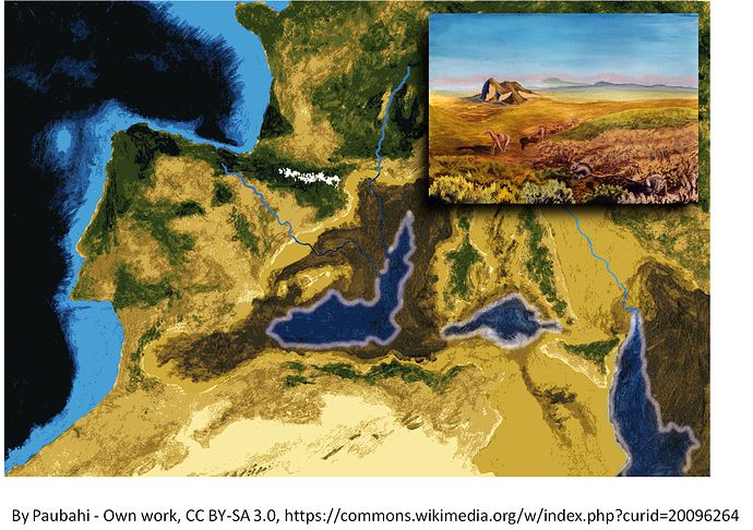
The question I have come to is "How on earth did Genesis 2:8-13 come to describe the geography of the eastern Mediterranean sea bottom, which at the time was dry land during the Messinian Salinity Crisis?" And that location for Eden lies in the only flood in geologic history that is local, and matches precisely the description provided by Genesis 7 and 8.

8 And the LORD God planted a garden eastward in Eden; and there he put the man whom he had formed. 9 And out of the ground made the LORD God to grow every tree that is pleasant to the sight, and good for food; the tree of life also in the midst of the garden, and the tree of knowledge of good and evil. 10 And a river went out of Eden to water the garden; and from thence it was parted, and became into four heads. 11 The name of the first is Pison: that is it which compasseth the whole land of Havilah, where there is gold; 12 And the gold of that land is good: there is bdellium and the onyx stone. 13 And the name of the second river is Gihon: the same is it that compasseth the whole land of Ethiopia. 14 And the name of the third river is Hiddekel: that is it which goeth toward the east of Assyria. And the fourth river is Euphrates." The Holy Bible: King James Version. (2009). (Electronic Edition of the 1900 Authorized Version., Ge 2:8–14). Bellingham, WA: Logos Research Systems, Inc. (Note, all Bible quotations come from this source)

Six million years ago the strait at Gibraltar closed, cutting the Mediterranean off from its main source of water. In the Mediterranean basin, more water evaporates from it than rivers can supply. Because of this, the entire Mediterranean sea dried up, leaving a few big brinish lakes and the rest was desert or grasslands where the rivers flowed in. Things were very different back then. Let's take a look.

The first river is the river Pison and it is said to compass the land of Havilah. Genesis 25: says: And they dwelt from Havilah unto Shur, that is before Egypt, as thou goest toward Assyria.

This places Havilah in Arabia or the Sinai. In 2019 Matt and Ryan presented a paper on this question at an AAPG sponsored geological conference.

Yossi Mart and William B.F. Ryan Abstract

"The offshore extension of Afiq Canyon is a deep valley, buried under thick Plio-Quaternary sediments beneath the continental slope off the southern coastal plain of Israel. ... Additional valleys of similar dimensions and characteristics to the marine extension of Afiq Canyon occur elsewhere along the continental slope of the entire Levant, suggesting that several rivers of the fluvial system of the Levant, which drained northwestern Arabia to the Mediterranean Sea during the Oligo-Miocene, still prevailed in the Messinian. The Afiq Canyon and its offshore apron as well as equivalents such as the Nahr Menashe fluvial system off Lebanon, imply that the geography of the Levant during late Miocene differed from the present. The Levant Rift could not have been a continuous tectonic depression as it is in the present, but rather a sufficiently disconnected series of grabens that allowed large rivers to still flow in between. The presence of the Afiq apron of substantial volume and with a thickness approaching 200 m along its apex confirms active fluvial systems feeding their bedloads into the Mediterranean as recent as 5 million years ago." 1

This is the Pison river system and when the Mediterranean was a dry mostly arid land, this river flowed over the present continental shelf and ended up on the former Mediterranean sea bed.

The second river is easy to identify because the only river that encompasses the land of Cush/Ethiopia between the White and Blue Nile tributaries, is the Nile river. During the Messinian Salinity Crisis, the Nile river cut the biggest Grand Canyon that ever existed. It cut over 4000 m into the African granite during this period.

"During the MSC the Nile created an enormous canyon, measured at a depth of more than 4000m below sea level in the offshore area of the delta."2

The sands it transported into the Mediterranean are shown on the picture below. The sharp linear cutoff of the yellow Nile sands is due to where the seismic survey stopped:

Rivers and Sediments from Rivers with afiq fm.png


The southernmost red arrow in the picture above marks where the Pison entered the Mediterranean Sea. That is crooked lines it points to is the Afiq canyon mentioned above. Below is a picture of Afiq canyon from another paper, it is an enlargement and a bit fuzzy but can be read.
Afiq evaporitic clastics.png

We now have two of the Biblical rivers coming together on the floor of the dry Mediterranean basin.

The third river is the Tigris. It is called Hiddekel in Daniel 10:4

"as I was by the side of the great river, which is Hiddekel"

Since the other river is always referred to as the Euphrates, Daniel had to be in the Tigris.

The precise location of this river's entry into the system is not completely clear. It might have joined the Euphrates onshore. We know that because Arabia was then draining its water into the Mediterranean, the Tigris couldn't flow south because of topography. It was updip that direction at that time. So, the Tigris is boxed in by the Euphrates draining to the Mediterranean and the Pison draining to the Mediterranean. Logic dictate that this river entered the Mediterranean basin. My current best idea about where it entered that sea, was a data point I once thought was the Euphrates. Just north of the Lebanese/Syrian border a big river entered into the dry Mediterranean sea at that time. Below is the surface slice from 3d seismic showing there is a big river channel entering the Med which I have marked on the picture. The channel is about 3 km wide which means it was a major river. The Green sediment fan shown in the first picture has to be the Euphrates, because it is closest to Turkey where that river is sourced. The Tigris river is sourced further east in Turkey.
Tigris channel marked.png


The fourth river is the Euphrates, as it is named. It entered the Mediterranean through the province of Hatay, Turkey. The green sands, the Nahr Menashe, shown in the picture below the blue sediments are from the Euphrates river, which even today gets about 62 miles from the Mediterranean coast at just this location. Today uplift along the coast turns the Euphrates away from its closest sea and heads it to the Persian Gulf.
Rivers and Sediments from Rivers with afiq fm.png

This is because the crash of Africa into Eurasia has changed the tilt of the land since then. But during the Messinian Salinity Crisis, when the Mediterranean was dry, the Great Euphrates dumped its sand in the same place we find the Pison and Nile(Gihon) dumping their sands. The waters of these 3 rivers would have intermingled.

Putting this all together, this is a schematic of what I think the preflood rivers looked like and how they related to each other. Let's start with what Scripture says:

“And a river went out of Eden to water the garden; and from thence it was parted, and became into four heads” Gen 2:10

That description can be matched precisely so long as one treats the word translated as ‘heads’ as meaning “primary or chief or main”.Ro'sh can mean this. Under this word choice,it reads,

And a river went out of Eden to water the garden; and from thence it was parted, and became into four main [rivers].

Doing that, and placing Eden in he midst of the main rivers,and making the area west of Eden into something that resembles the Okovango Delta of the Kalahari desert, or the Sudd or South Sudan, then one gets the following picture.
Eden revision 5.png

The area west of Eden in this scenario would look something like the Sudd swamp of southern Sudan. From Google maps, you can see channels going every which way:
Sudd as example of Med floor.png


Eden's geography can be quite real and quite historical. The question is, are you willing to go where the data of geology and the data of the Bible lead?

Now, I have shown that at one time, 5-6 myr ago, the rivers of Eden met on the bottom of the dry Mediterranean basin. I think that is where Eden was. The geography is real, but it isn't applicable to our time. Geography changes.

So, here is the question, How is it that the Bible mentions these 4 rivers which are impossible to be together today, but which were together 5 myr ago in a basin that experienced the most massive flood every known. That flood would have matched Noah's flood as described.

1. Noah's flood lasted a year. Geological cores from the flood layer show that the filling was extremely rapid--within an inch of sedimentation. Calculations show that it would have taken about a year to refill the Mediterranean 8.4 months to 2 years are recent estimates.

2.That flood would have covered many high mountains within the basin, but whose tops were below sea level. Noah's flood says the same thing. "Fifteen cubits upward did the waters prevail; and the mountains were covered" Gen 7:20

3. If you read the word 'eretz' as land rather than as planet earth, then Genesis 7:21 is absolutely true:

And all flesh died that moved upon the earth, both of fowl, and of cattle, and of beast, and of every creeping thing that creepeth upon the land, and every man: 22 All in whose nostrils was the breath of life, of all that was in the dry land, died.
4. Constant rain would occur because the flood waters filling the basin would push moist air up which would cool, condense to clouds and cause long periods of constant rain.

5. Furthermore, in Gen 6:11, God says he will destroy the 'eretz' (land). And God said unto Noah, The end of all flesh is come before me; for the earth is filled with violence through them; and, behold, I will destroy them with the earth. This can't happen with a global flood; we still have land. It doesn't happen with a Mesopotamian flood--Mesopotamia is still there. But with a big local flood, like the infilling of the Mediterranean, that land has actually been destroyed. It no longer exists.

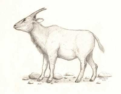
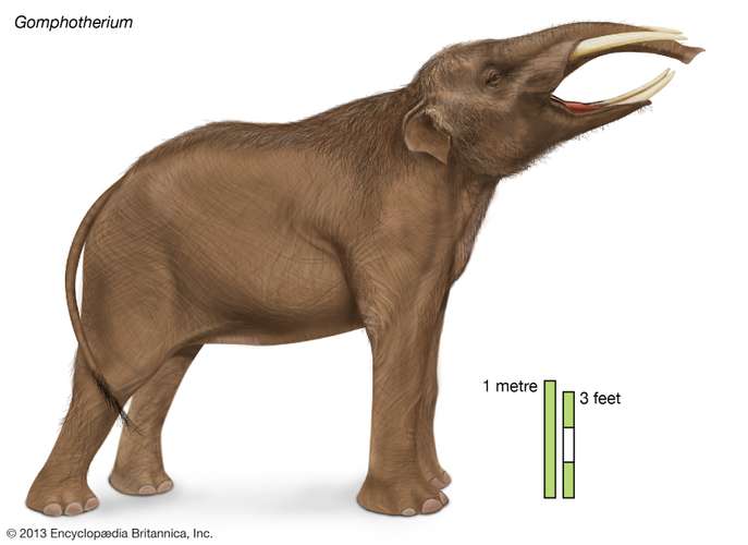
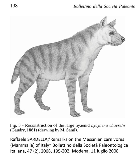
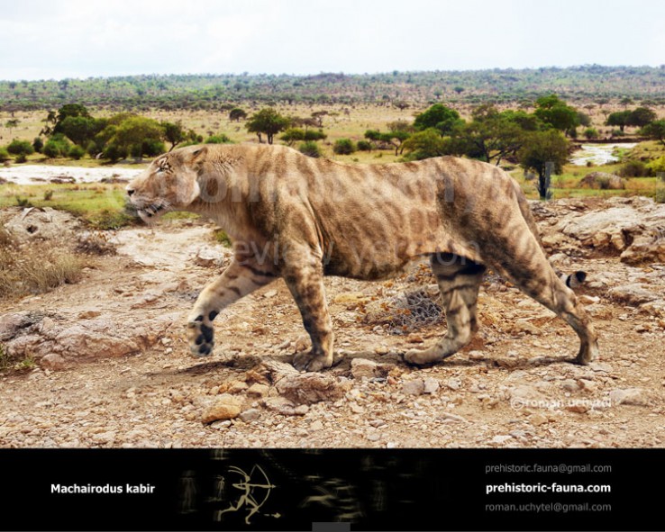
To top this off, this time period was when Hominids first appear on earth. This is the only time we could have had a primal pair of Adam and Eve. And this makes people nervous about having Adam be a small brained person. I have a series of posts here which discuss this and other issues.

Now, once again, is it blind chance or divine inspiration that the Bible describes a geography that actually existed 5.3 myr ago? Will you follow the evidence or not?

References
1.
http://www.searchanddiscovery.com/documents/2019/51612mart/ndx_mart.pdf
2.Angelos Mousouliotis et al, " Siliciclastic Deposits of the Messinian Nile Canyon, Herodotus Basin, Eastern Mediterranean", Geoscience Technology Workshop, Exploration and Development of Siliciclastic and Carbonate Reservoirs in the Eastern Mediterranean, Tel Aviv, Israel, February 26-27, 2019http://www.searchanddiscovery.com/abstracts/html/2019/telaviv-90341/abstracts/2019.TelAviv.12.html
 

Chris V++

Associate Member
Site Supporter
Mar 16, 2018
1,628
1,439
Dela Where?
Visit site
✟674,903.00
Country
United States
Faith
Non-Denom
Marital Status
Married
Greetings. Sorry I didn' t have time to read your entire post but skimmed most of it and plan on coming back to read it more carefully. If you can rent this documentary on line you would find it interesting since it includes interviews with PhDs including a geologist. He is interviewed in the Grand Canyon region and points out evidences for a global flood everywhere on the planet. https://isgenesishistory.com/produc...MIkamx8du26QIVU-J3Ch2ZqQgIEAAYASAAEgJievD_BwE

From a laymans perspective, the Noah flood model that I've seen that fits most with geology is that the uplift happened during or soon after the flood, which is why they find the marine fossils on mountain peaks. Also there is a lot of recent talk that the entire planet was under water at one point or another, but they don't believe all areas were submerged simultaneously, but during different eras.

1.5 billion-year-old Earth had water everywhere, but not one continent, study suggests | Live Science

Early Earth was covered in a global ocean and had no mountains
 
Upvote 0

Gbob

Active Member
Site Supporter
Apr 28, 2019
80
37
74
College Station
✟56,139.00
Country
United States
Faith
Christian
Marital Status
Married
Greetings. Sorry I didn' t have time to read your entire post but skimmed most of it and plan on coming back to read it more carefully. If you can rent this documentary on line you would find it interesting since it includes interviews with PhDs including a geologist.

I need to give more introduction. for 17 years I was a young-earth creationist, publishing 30+ young earth articles, mostly in CRSQ. But at work, every day I had to work with seismic data which clearly showed that there were so many problems with the Global flood that I eventually was forced to give up on that idea. Most of my Creation Research Society articles were attempts to solve the problems I saw daily at work. And they all eventually failed in light of new evidence. That is when I started my 15 plus years of serious doubt about Christianity. As a young-earther I had been told and believed something that Harold Slusher told me over breakfast one morning in El Paso. "If God can't be creator, then how can he be savior?" I believed that then and I believe it today, but today, I have answers, not answers that young earthers will like, but answers that match observational data. My views are very different but I do believe in a historically and scientifically accurate Bible. I don't want to turn my thread into an anti-yec thread because we share a very important common belief, that the Bible must be true. The liberals, I believe, prefer to have a false Bible. Anyway, just for your information I have had PhD geologists working for me throughout my career, so what they say doesn't always impress me. Nor should it impress you. I know Steve Austin and his brother Joe. I knew Gish, Henry Morris, John Morris, Tom Barnes, Harold Slusher and lots of the older creationists active in the 80s. I know their arguments quite well, maybe better than most. Tomorrow I will post another part of my views on how to make Scripture absolutely historically and scientifically true.

Hint. If I am correct, Eden is in the only place where modern geology agrees that there was a flood that matched the Biblical description of Noah's flood. And the strange hydrology, mists, rivers splitting is explained because that hydrology only happens in a deep basin! Here is a video of the catastrophic flooding of the Mediterreanean which the above post hinted at. here. and here in this second video, the black sea flood never happened. The data says so, and this video is a bit out of date.
 
  • Informative
Reactions: Job 33:6
Upvote 0

Gbob

Active Member
Site Supporter
Apr 28, 2019
80
37
74
College Station
✟56,139.00
Country
United States
Faith
Christian
Marital Status
Married
Trying to take today's earth and find anything in The Tanakh to match is useless. The original earth created in Genesis was one single flat piece of land that was surrounded by the sea.

Taking that appraoch to Scripture automatically makes the Bible a false document! If that is what you want, have at it. I don't. I don't think it is as important to Biblical interpretation what the ancients thought about it but what God thought about what he was communicating.

You should read the book, "Inventing the Flat Earth," This view was originated by enemies of Christianity. Go to this and look for 'Flat Earth Cosmology." section. The only ancient I ever found who actually believed a flat earth was Cosmas Indicopluestes. I did philosophy of science for a year in grad school and I never ran into a classical Greek who believed in a flat earth, and given that Raquia has the connotation of expansion, it really boils down to the Septuagint's choice of 'firmament' for a word meaning expand or expanse. This is where the solid Platonic Crystalline spheres came into Judeo-Christian theology. Alternatively, go read

Randall W. Younker and Richard M. Davidson, The Myth of the Solid Heavenly Dome: Another Look at the Hebrew (Raqia), Andrews University Seminary Studies, No. 1(2011), 125-147, p. 125 https://digitalcommons.andrews.edu/cgi/viewcontent.cgi?article=3130&context=auss
 
Upvote 0

Gbob

Active Member
Site Supporter
Apr 28, 2019
80
37
74
College Station
✟56,139.00
Country
United States
Faith
Christian
Marital Status
Married
The Strange Hydrology of Eden
Glenn R. Morton 2020

As a geophysicist of 47 years experience all around the world, I view some parts of the Bible differently than theologians who don't know much geology. As a geoscientist, I know that the hydrology described is highly unusual--mists, rivers splitting into four big rivers etc. I have arrived at a professional conclusion, this kind of hydrology can only exist in a flat bottomed basin. Interestingly, there is a massive, US-sized dry basin right next to where the Nile, Euphrates, Pison and Tigris flowed five and a half million years ago. As you read, enlarge the pictures to see for yourselves what I am saying abou them.
Messinian paleogeography.png


For those who might not have heard that this basin was empty the information can be found here, and those who wonder about the Biblical rivers being together, can find that information here.

Many won't like how far back in time this is. That is too bad because you will miss seeing things from the Bible match up with modern geologic knowledge.

I place Noah's flood in the dry Mediterranean basin because it is the only cataclysmic flood which matches the Biblical description. It filled up in about a year's time, the basin was up to 5 km deep, meaning any mountain less than 5 km high would be covered by this flood, and the fact that the rivers flow into this area at that time, makes this basin a prime geological candidate for being Noah's flood.

No Rain
for the LORD God had not caused it to rain upon the earth,

This is an interesting passage which rules out Mesopotamia as the site for Eden. Mesopotamia was a well-watered region throughout geologic time. Where I place Eden was in a deep dry Mediterranean basin, which is a real geologic event. Deep basins like the Dead Sea or Death Valley, get very little rain, but this basin, the dry Mediterranean basin was likely 10-12 times deeper than either of those. Plus the eastern end of the basin was the upwind direction for the prevailing wind, and that means that air dropping into that part of the basin, would lose water saturation as it dropped, and thus making rain almost impossible.

Mists Galore

As I said, the hydrology described by Scripture only works in a flat bottomed deep basin. Consider Genesis 2:6:
But there went up a mist from the earth, and watered the whole face of the ground.

Other than areas with hot geysers, I cannot think of anywhere that is watered by mists rising from the ground. I once owned a ranch and had a small temporary spring. Water which landed on the adjacent hill, (about 20-30 feet higher than the spring), would seep through the hill's rocks and bubble up in this low area. It would last about 2 weeks after a rain. While it didn't have the energy or pressure to spray into the air, water which drops several thousand feet in rocks very well could have had the pressure to form a mist when they spewed into the deep dry, Mediterranean basin.

So how did that happen in Eden? Below is a cross section of the geology of central Israel. Note the geologic rocks are dipping to the west, towards the Mediterranean Sea.
EW cross section israel.png


If we extend those dipping sediments to the continental slope, where the continent meets the ocean basin, it would look like this, you can see where the water would be spewing out.:
Cross section of Israel artesian well.png


This geometry of rocks is certain to yield artesian flow at the continental edge. The situation would be a bit more complicated than what I have shown, but this simplification shows the basic idea. Artesian wells occur only in valleys, never on top of the mountain.

Egypt's coast at the time is a bit more complicated but I will go step by step. One thing to know about me is that I was geophysical manager of the Gulf of Mexico for 10 years for an oil company and the knowledge I learned there about salt movement will come in handy here. Below is what the coast of Egypt looks like today.

Egyptian coastline.png

Everything above the orange Abu Madi formation and the purple salt, has been deposited after the Mediterranean flood. We will restore the geology to approximately what it was like when the basin was dry. The first thing is to know where the salt was originally. As you move NE from the left of the cross section you will see the first set of faults (semi-vertical lines cutting through the rocks). In this area, the faults are cause by salt movement and those faults show where the salt used to be. See below:

Egyptian coastline1.png


Now we will remove all the post flood sediment and restore the salt to its original position:
Egyptian coastline2.png


The places I marked the possible artesian locations are channel cuts into the Abu Madi (first 3 from the left) and small thrust faults shown on the cross section in he middle of the section. Given that the rain falls on Egypt, 5 km higher than this surface was at the time the Mediterranean was a desert, there would have been a lot of pressure to these artesian wells.

I know the Abu Madi formation is capable of artesian flow because it is made of sand and shale. The sands today are filled with natural gas produced by the Egyptian oil industry. a cross section from another place illustrates how faulting could be the source of some artesian flow.
Abu Madi cross section.png


I have shown that it is quite possible for what the Bible says to be true. Mists would have arisen in this land regardless of whether one accepts this as Eden's location or not.

The Right Rivers!

The second clue that this dry basin marks Eden comes from the fact that this is the only time in geologic history that the Nile, Euphrates, Pison and Tigris flowed into the same region. See the first map in this post or for more detail see here. Today, the Euphrates, Tigris and the area drained by the Pison(it no longer exists), empty into the Indian Ocean. The Nile still empties into the Mediterranean. If The Bible is true about these river, then this is the only time and place where one could make a case for a real Eden. If this location is rejected, then Eden becomes a fantasy as many of our theologians and atheists, have claimed.

"Skinner claimed: 'it is obvious that a real locality answering the description of Eden exists and has existed nowhere on the face of the earth...(T)he whole representation (is) outside the sphere of real geographic knowledge." John C. Munday, Jr., "Eden's Geography Erodes Flood Geology,"Westminster Theological Journal, 58(1996), pp. 123-154,p.128-130

All I can say to Skinner is that there was a time when a locality answering the description of Eden existed. He just didn't have the requisite geological knowledge.

This event comes at the same time as genetics says the oldest human genes originated. It is the only time genetically we could have a primal pair of parents. Isn't that an interesting coincidence? But one will object, only small brained hominids lived at that time. That is true, but one Homo Sapiens, named Daniel Lyon, lived a full life in New York, having normal intelligence but the brain size of a two million year old hominid, H. habilis. Daniel Lyon lived a normal life, showing brain size doesn't matter to one who bears the image of God. Furthermore the curses of Eden both involve the brains of Adam and Eve's descendants getting bigger. If they are Neolithic farmers as everyone claims, why curse them with something they already have, namely problems arising from having a big brain?

Rivers Splitting

Another odd thing about Eden's hydrology concerns the splitting of rivers. Scripture says (Genesis 2:10):

"And a river went out of Eden to water the garden; and from thence it was parted, and became into four heads."

Rivers don't split right after the spring that starts them. The only time rivers split into distributaries is when they are on flat land or at their delta, near sea level. This hydrology is telling us that Eden was at a delta or on extremely flat land. The bottom of the Mediterranean desert five and a half million years ago would satisfy that requirement. It requires a deep flat basin for this to happen.

Well, if we assume that Eden was near where the four rivers poured into the basin, and the Edenic river was sourced by an artesian well, as described above, then below is what I think Eden looked like in diagrammatical form:
Eden revision 5.png


In our world, one river doesn't source four others. So what could this word 'head' mean? The Hebrew word means 'head', 'chief', or 'principal'. Its definition says nothing about water, or headwaters. But some interpret that verse as requiring that this Edenic river be the source of the other rivers. Now, I had an interesting debate about the word 'heads', but the debate got me thinking and I figured a way to explain this if it does indeed mean headwaters. Notice that I have one green river flowing out of Eden and its distributaries, empty into the four other rivers. I am going to suggest that even if you require Eden's rivers to be 'headwaters', a requirement not imposed by the Hebrew but by one's bias, then there is a way to have these rivers as 'heads'.

If our continent had first been settled in Oregon, and people crossed the mountains and found the Missouri river and gave it a new name, let's say, the Toodles river, they would float all the way to Southern Louisiana on the same Toodles river. They would give names to each of the tributaries they passed and in this scenario, we would consider the headwaters of the Toodles to be in Montana and Wyoming, not in Minnesota. What I am saying is that what we call a river's headwaters, is an accident of history. It was Henry Rowe Schoolcraft in 1832 who named the source of the Mississippi river. He called the lake which he decided was the headwaters of the Mississippi, Veritas Caput. He could have named any of the thousands of heads as the headwaters of the Mississippi. Below are all the possible headwaters of the Mississippi river
Headwaters of the Mississippi.png


Any one of the above headwaters could have been called the head waters of the Mississippi, in other words, they are all heads of the Mississippi river.

While most people will not like Adam being as far back as I place him and won't accept this theory for that reason alone, I have shown above that the strange hydrology of Eden can only fit a deep basin locale. Furthermore,

1-this is the only time in geologic history that the four rivers of Eden are found interacting together in one real place.
2. This is the only place where a flood matching the Biblical description of Noah's flood actually happened.
3. Only in a deep basin like this can the lack of rain and mists be explained.

The geology is sound. The question is will you follow where the data leads?
 
Upvote 0

Chris V++

Associate Member
Site Supporter
Mar 16, 2018
1,628
1,439
Dela Where?
Visit site
✟674,903.00
Country
United States
Faith
Non-Denom
Marital Status
Married
If I am correct, Eden is in the only place where modern geology agrees that there was a flood that matched the Biblical description of Noah's flood. And the strange hydrology, mists, rivers splitting is explained because that hydrology only happens in a deep basin!


That's great to know there is some agreement! I've conversed with agnostics and atheists who have accepted the idea of a local flood and use the Epic of Gilgamesh to support that localized flood model. We know Jesus mentioned the flood as fact but I don't remember if He spoke to its breadth. To me the fact that they find marine fossils on mountain peaks and in the centers of continents suggests a wide scope, but I'm just a layman who takes it on faith and I don't have the resources to verify any of the claims on either side of the argument.
 
Upvote 0

Gbob

Active Member
Site Supporter
Apr 28, 2019
80
37
74
College Station
✟56,139.00
Country
United States
Faith
Christian
Marital Status
Married
Glad we can agree on one thing. The problem from most Christian's view of my flood theory is the time it happened. I just think we Christians have not thought creatively enough about these things.

I would point out that fossils on mountain tops don't mean much because the fossil might have been deposited in the ocean and then uplifted. One of the earlier issue I kept running into when I was a young-earth creationist was the evidence of much time in the geologic column. Below is an example.It was a seismic line I have marked up to show the features, via the write up below:
appalach1.jpg


The line was one shot by Texaco along the Alabama/Mississippi border just NE of Meridian, Mississippi. The reference is A. W. Bally, _Seismic Expression of Structural Styles, Vol. 3, AAPG Studies in Geology Series, #15,, p. 3.4.1-82. It shows a wonderful example of why slow sedimentation must be the rule and presents a big problem for the global flood. A word about seismic. The black peaks and grey
troughs are the reflections of sound off of various rock layers which are in the earth. By reflecting the sound, we can produce a picture, like this, of what the earth looks like under one's feet. The picture is about 20 km of seismic data. It can be seen that the valley in the unconformity is about 3 km wide. The thrust block is about 16 km or 9 miles long. Such pictures are no different than what a doctor
produces when they do a sonogram.
>
At the top of the section are the sediments of the Atlantic coastal plains. They are flatish-lying dipping slightly to the SE. They are about 3500 feet thick and consist mostly of sands and shales. They lie on top of a major unconformity which separates the Paleozoic Appalachian sediments from the Atlantic Coastal plain sediments. Below the unconformity is the Paleozoic sediments which consist not only of sands and shales but also very thick piles of carbonate and dolomite. dolomite. They are around 18,500 feet thick. This is determined by the velocity of sound in those sediments. Rocks in the Paleozoic are almost always faster than rocks in the younger Mesozoic and Mesozoic rocks in general are even faster than those from the Tertiary.
>
If you look below the unconformity you will find a thrust fault having thrusted the Paleozoic sediments over on top of themselves Bed a is marked on both sides of the thrust fault and one can clearly see that it is overthrusted on top of itself. The friction of the thrust plane against the upper part of the thrust caused the sediments to be folded. The fold was then eroded. Since bed A to the right is buried by 1.3 seconds of Paleozoic sediment (approximately 10,000 feet), yet it intersects the unconformity where it is covered by NO Paleozoic sediment, this means that 10,000 feet of sediment was eroded from the point marked 'hill'. If you look at the sediments just under the unconformity on the right and move to the left you will see layer after layer erosionally truncated by the unconformity until you get to hill where bed A is at the surface of the unconformity.
>
Where I marked a hill, If you look at the unconformity, you will see that it drops down at that point. the flat reflectors above are clearly onlapping the unconformable surface against the hill. The valley was eroded into the underlying Paleozoic sediments PRIOR to the deposition of the Mesozoic sediment. If you look just to the right of the hill, under the word valley, above the unconformity you will see a
black reflector which runs into the hill to the left and then into the unconformity on the right. The relationship between this reflector and the unconformity shows that the valley to the right of the hill was infilled in a rather gentle way otherwise the sediments would be chaotic. This valley was probably an arm of the ocean at one point because the sediments that fill it are marine as are all the Atlantic Coastal Plain sediments.
>
After the Mesozoic sediments were deposited, the entire area was slightly tilted to the SE.
>
The sequence of events cause great problems for the concept of a global flood. Global flood advocates always say that fossilization can only occur during catastrophic events such as the flood. Well there are fossiliferous Paleozoic sediments below the unconformity as well as above. Thus the flood advocate must hold that all the sediment in this picture is from the flood. This means that during the flood 18,500 feet of Paleozoic sediment must have been deposited. It must then have hardened. Why? Because of the way the thrusting deformed the rocks.

This is not a soft-sediment type of deformation. The upper thrust block moved as a solid block. If the sediments had been soft, this couldn't have happened. Soft ooze and mush won't transmit forces for 9 miles. Assuming that the Paleozoic constituted half of the flood's time, then in 6 months we must deposit 18,500 feet of sediment. This is a rate of 102 feet per day. There are slow-moving invertebrate fossils at the bottom of the Appalachian Paleozoic as well as at the top. All sorts of stationary shell-fish are found throughout the Paleozoic strata. Why everything wasn't at the bottom of the pile, after deposition of the first 102 feet on the first day, I can't comprehend. A further problem is the burrows which are found throughout the entire 18,500 feet of sediment. One must have exceptionally rapid burrowers in order to thoroughly burrow 102 feet of strata a day. That is enough sediment to cover a 10 story building each day. Next time you drive down the road, look at a ten story building and imagine it covered in sediment in one day and thoroughly burrowed by thousands of animals. Burrowed in such a fashion where the excavated sediments make a pile around the burrow which are then covered by the next layer which is a different lithology.
>
After the deposition of 18,500 feet of strata, and it's hardening (it takes lots of time for shales to de-water, yet we see no mega water escape structures in this sedimentary pile either), we must then have the time to thrust the paleozoic section creating huge mountains (the Appalachians). After this, we must have time for the erosion of 10,000 feet of HARDENED sediment, which then becomes the unconformity surface. Then we must cover, in a gentle way, the entire area with 3,500 feet of Mesozoic sediment. This is a rate of 19 feet a day assuming that the Mesozoic here represented 180 days of flood deposition. One could hardly say that 19 feet a day of sedimentation is 'gentle'. 19 feet of sediment where I live would nearly cover my 2 story house.

I don't see how to explain this in a global flood/young-earth scenario

The fossils on top of the big underground mountan shown in the seismic line were originally flat lying marine deposits.
 
Upvote 0

Chris V++

Associate Member
Site Supporter
Mar 16, 2018
1,628
1,439
Dela Where?
Visit site
✟674,903.00
Country
United States
Faith
Non-Denom
Marital Status
Married
The sequence of events cause great problems for the concept of a global flood. Global flood advocates always say that fossilization can only occur during catastrophic events such as the flood. Well there are fossiliferous Paleozoic sediments below the unconformity as well as above. Thus the flood advocate must hold that all the sediment in this picture is from the flood. This means that during the flood 18,500 feet of Paleozoic sediment must have been deposited. It must then have hardened. Why? Because of the way the thrusting deformed the rocks.
Again I'm just a layman, but is it possible assuming the Earth is not as young as the YEC claim, that multiple floods have occurred over spans of centuries in various localized areas all of the planet, resulting in fossils 18k feet deep like you 've shown, but then a global catastrophic flood also occurred during the time of Noah. creating newer layers of sedimentation. I don't see why the Noah flood would have to account for all layers of fossils assuming an older earth. On a recent trip to Bryce Canyon I remember a park ranger explaining that that was how Bryce Canyon formed- a series of floods and subsequent droughts over tens of thousands of years. Funny I just watched a documentary last night about geologists challenging the age of the Great Sphinx in Egypt due to it showing obvious signs of water erosion at its base. Plus the fact that some of the bricks the ancients used to restore and buffer it are said to be 4500 years old, so why would the Egyptians have had to restore it if they had just built it.

I would point out that fossils on mountain tops don't mean much because the fossil might have been deposited in the ocean and then uplifted
That's sort of what I"m banking on, that a lot of that uplift happened while the waters were prevailing on the earth. Sort of a combination of a flood, plate tectonics, underwater volcanism and subsequent glacial activity /glacial recession. I know that probably sounds naive.
 
Upvote 0

Gbob

Active Member
Site Supporter
Apr 28, 2019
80
37
74
College Station
✟56,139.00
Country
United States
Faith
Christian
Marital Status
Married
Again I'm just a layman, but is it possible assuming the Earth is not as young as the YEC claim, that multiple floods have occurred over spans of centuries in various localized areas all of the planet, resulting in fossils 18k feet deep like you 've shown, but then a global catastrophic flood also occurred during the time of Noah. creating newer layers of sedimentation. I don't see why the Noah flood would have to account for all layers of fossils assuming an older earth. On a recent trip to Bryce Canyon I remember a park ranger explaining that that was how Bryce Canyon formed- a series of floods and subsequent droughts over tens of thousands of years. Funny I just watched a documentary last night about geologists challenging the age of the Great Sphinx in Egypt due to it showing obvious signs of water erosion at its base. Plus the fact that some of the bricks the ancients used to restore and buffer it are said to be 4500 years old, so why would the Egyptians have had to restore it if they had just built it.

That's sort of what I"m banking on, that a lot of that uplift happened while the waters were prevailing on the earth. Sort of a combination of a flood, plate tectonics, underwater volcanism and subsequent glacial activity /glacial recession. I know that probably sounds naive.

I was area geophysicist for the East Coast of the US from 1981 to 1984 and examined all the seismic data offshore from Florida to Canada, there is no fault showing uplift of this continent. I have worked offshore UK, and China, same thing. Below is a picture showing what the offshore US looks like:
continental shelf.png

The continental crust is Sial = silica-aluminum and the oceanic crust is Sima=silica magnesia. Sediments are gently laid over the continental shelf edge as shown above.

Offshore Brazil looks similar in seismic data:
Prograding_Shelf_in_Santos_Basin_Brazil.jpg

Uplift would require faulting. Now I don't want to leave the impression there are no faults offshore, there are, just not the kind that uplift continents after the flood. Below is offshore North Island New Zealand. These are thrust faults which are caused by compressive forces. The lower picture is the interpreted version.
offshore New Zealand.png

To conclude, seismic data offshore doesn't support any widespread continental uplift at any time. The continents are floating blocks of Sial in a sea of more dense Sima.
 
Upvote 0
This site stays free and accessible to all because of donations from people like you.
Consider making a one-time or monthly donation. We appreciate your support!
- Dan Doughty and Team Christian Forums

Gbob

Active Member
Site Supporter
Apr 28, 2019
80
37
74
College Station
✟56,139.00
Country
United States
Faith
Christian
Marital Status
Married
Edited to add: I have terminal cancer and I don't know how long my strength will hold out having been told in January I have 6 months and I am beginning to believe them. Anyway, should I not finish or just disappear, my blog with much of this information is at The Migrant Mind Tomorrow I will talk about the life that lived in this deep basin.

In two previous posts I suggested that Eden was in the desiccated Mediterranean basin 5.3 myr ago. There are so many things from the Bible that fall into place if we place Eden where I suggest.

1. 1-Deep basins get very little rain, especially the end of it which is on the upwind side as was the Eastern Med at that time.for the LORD God had not caused it to rain upon the earth" I would translate ‘earth’ as land’ for that is the most common meaning of ‘erets’. So we need to look for a land where it didn’t rain. That rules out Mesopotamia.

2. 2-No rain, no rainbow. The special mention of the rainbow after the flood indicates to me that it is a novel phenomenon.

3. 3-The Bible gives us a hint about when Eden was. " and there was not a man to work the ground*." This was before the Neolithic-- And the beginnings of agriculture go back as long ago as 15,000 years. Thus Eden was prior to 15,000 years ago. The word translated as till mostly means ‘work’, so that is what I chose to do with that verse.

4. 4-the hydrology described in Eden can only happen in a deep basin.–rivers splitting into many, and artesian flow causing mists out of the ground. 5.3 myr ago is the only time such a deep basin existed on earth, The hydrolic head on artesian flow would be large in a 12,000 ft deep basin, the only one that ever existed on earth.

5. 5-When the dam at Gibraltar collapsed, Atlantic waters roared into the basin at 223 mph. This is the fountains of the deep, or a good imitation thereof. Here is a numerical model of the catastrophic flood. 100 m/s is the red–that is over 200 mph.

water speed.png


6. 6-This flood lasted 8 months to a year. The model above says it took 200 days for the eastern basin to be filled. If the eastern basin was what Noah was aware of then we are somewhat close (models can be tweaked) to the Noah entered the ark 2nd month, 17th day. the ark grounded on the 7 month 17th day. That is 5 months or 150 days. A bit bigger opening to the Atlantic in the model above would solve that misfit.

7. 7-Because the basin was about 12,000 feet deep, this flood also covered high mountains. “And the waters prevailed exceedingly upon the land; and all the high hills” Mesopotamian flood have no high hills to cover! The land is very flat. This is the only flood in geologic history of which I am aware that matches the Biblical description of Noah’s flood.

8. 8-This happened at the time hominids (our group) first appear on earth.

9. 9-This time 5.3 or so myr ago is the only time genetically we can have a primal pair. Our oldest genes are this old! And most don't know that the average age of a human gene is just shy of 1 million years. This is based upon known rates of mutation in human DNA.

Old Genes.png


I believe that all the pre-flood events took place in this basin. If you think about this basin, it is surrounded by 3-5 km mountains in all directions. There are 1-4 km mountains inside the basin as well. It is a vast basin and Eden somewhere in the Eastern part of it. My PSCF article which was the first to suggest this location can be found here.

The closure of the Gibraltar Strait created the biggest canyon the world has ever known. 3 to 5 km deep and nearly a million square miles in area. This has been known since the 1970s, but could not have been known by any ancient Hebrew, yet somehow, this information got into the Bible, that four specific rivers were involved in Eden. It couldn't have bee passed down by oral tradition. It has to be divine inspiration. Kenneth Hsu writes of the Mediterranean:

"The Mediterranean is an area of strong evaporation; by the middle Miocene it was reduced to an empty desert basin dotted with playas in which strong brines deposited gypsum and anhydrite with at least one bored thick deposit of rock salt. That this former (and present) sea area should have been reduced by evaporation to a desert 3,000 m below sea level during the Miocene seems unbelievable, but the distribution of evaporites in a pattern of desert lakes, the existence of high temperatures (anhydrites are precipitated only above 35 C) and the occurrence of stromatolitic dolomite (which requires sunlight for its development, not the gloom of ocean depths), and the occurrence of mudcracks filled with windblown silt in some cores, is strong evidence. The Red Sea basin was similar. And finally, countries around the Mediterranean -France, Algeria, Libya, Syria Israel and others- have very puzzling gorges, cut through hard rocks and descending in the coastlands as much as 1,000 m below sea level. Even the rivers which cut these Miocene gorges were insufficient to counteract the high evaporation rate of this appalling Miocene Basin. "1

The Nile canyon north of Cairo gets as deep as 3500 m, which means that floor of the Mediterranean was nearly 4 km deep at that time.2

We have an empty basin with the rivers of Eden flowing into the eastern basin floor, other rivers flowed into the basin further west, one off of Libya and a couple off of France, but they are far to the west of where I say Eden was. But way to the west, at the Strait of Gibraltar, the clock was ticking. Water was seeping over the top of the dam at Gibraltar, slowly eating away the dam, and maybe seeping through the rock itself, destroying its cohesion. But, 120 years prior to the dam's failure, God spoke to a righteous man.Gen 6:13:

"And God said unto Noah, The end of all flesh is come before me; for the earth is filled with violence through them; and, behold, I will destroy them with the earth"

It says God will destroy the land along with the man. Mesopotamian flooding didn't destroy the land. Mesopotamia still exists. Even in the global flood, the 'land' was not destroyed; it was just re-arranged. The Mediterranean Flood destroyed a large land, which has never been seen as land again. This view is consistent with what many scholars have said of Eden, that it is utterly destroyed. Martin Luther said,

"Hence my opinion...is, first, that paradise was closed to man by sin, and secondly, that it was utterly destroyed and annihilated by the Flood, so that no trace of it is visible any longer---For the entire surface of the earth was changed."3

Gen 7:11-13, 19-22, 8:1-4 describes the flood

" 11 In the six hundredth year of Noah’s life, in the second month, the seventeenth day of the month, the same day were all the fountains of the great deep broken up, and the windows of heaven were opened. 12And the rain was upon the earth forty days and forty nights."

...

"And the waters prevailed exceedingly upon the earth; and all the high hills, that were under the whole heaven, were covered. 20 Fifteen cubits upward did the waters prevail; and the mountains were covered. 21 And all flesh died that moved upon the earth, both of fowl, and of cattle, and of beast, and of every creeping thing that creepeth upon the earth, and every man: 22 All in whose nostrils was the breath of life, of all that was in the dry land, died."


...


"And God remembered Noah, and every living thing, and all the cattle that was with him in the ark: and God made a wind to pass over the earth, and the waters assuaged; 2 The fountains also of the deep and the windows of heaven were stopped, and the rain from heaven was restrained; 3 And the waters returned from off the earth continually: and after the end of the hundred and fifty days the waters were abated. 4 And the ark rested in the seventh month, on the seventeenth day of the month, upon the mountains of Ararat"

I want to point out that many critics claim that the 'windows of heaven' refer to the supposed windows in the raqiya. See my Days of Proclamation post for why the entire idea of a solid dome is unsupported by historical data. More to the point, the word here for heavens, samayim, means sky, as in atmosphere. It is a euphemism like we say cloud burst, when the clouds do nothing of the kind.

Secondly, I would note that the description of the flood is of no common variety. The YECs are correct in that view. The commentators who place the flood in placid places like Mesopotamia, which is FLAT, can't possibly be using the Biblical description of the flood when they decide the location. The Flood was massive, widespread, long and terrifying. The breach at Gibraltar had Atlantic oceanic waters spew into the Mediterranean at 223 mph. (100 meters per second is 223 mph).

water speed.png


Thirdly, I can think of no better term for the dam failure at Gibraltar, than fountains of the deep. Strong's defines it: "deep, sea, abysses (of sea).1C primeval ocean, deep "4 This term refers to the ocean, and Mesopotamian floods are not from the ocean. No, Tsunamis can't reach Mesopotamia because the shallow Persian Gulf can't support the long wavelengths tsunami's have. Thus, once again, those who would place the flood in Mesopotamia ignore what the Scripture says.

Finally, I think the wind is what drove the Ark to ground on the Taurus mountain range, see map above. The Taurus Mountain Range is the Range running Through Turkey. A careful observation of the Upper Miocene paleogeography on that map shows that the ark might have been able to land on what became the kingdom of Uratu.

The Need for an Ark

Walking out of this basin would be very difficult and just getting to the top of the continental platform might not save you. Why? Well, you need to know that moist air forced upward causes rain. This is why there is more rain on the western side of the California mountains than there is in Nevada and Utah. The air rises against those mountains and dumps the water and when the air comes down in Nevada and Utah, the moisture is gone; the air is dry. Now, the empty Mediterranean basin contained 4 thousandths of today's atmosphere, I once calculated. That much air, brought to sea level pressure would fill a band 400 km wide along the edge of the Mediterranean Sea. This means, as the waters fill in the basin, the air picks up the moisture, rises along the basin edges, rain starts and then after the air gets to the top of the continental platforms of Africa, Asia and Europe, the moist air would move horizontally like a weather front, creating more rain in that 400 km wide band. Further, as long as the waters were rising, the rain would continue. It is often noted that 40 days and 40 nights is a euphemism for a long time, I think the rain lasted most of a year. Thus, there had to be an ark.

The Ark

No I don't think it was as big as what Answers in Genesis believes, but It was big enough to bring selected animals and enough food for the ride. Plenty of rain water was going to be available to drink--for an entire year.

The Dam Breaks

One fine lovely day the dam at Gibraltar broke and the waters pour through the breach at over 200 miles per hour! Think of the massive plum of water, part of which probably went air-borne as it fell into the abyss miles below. If this doesn't fit the phrase, 'fountains of the deep', I don't know what does. The 'deep' is the word for oceans, and this breach at Gibraltar is the only case in geologic history where the ocean poured into such a deep basin.

There is a fine computer simulation of this event, and they even entitle it Noah's flood, but give me no credit for being the very first person to ever publish on this concept. Oh well, the video is worth watching but do it after you finish reading this or come back after you see the video. They also show the Black Sea infilling in the 2nd part of the video, but that never ever happened. The Black Sea Flood no longer is even believed by those who first proposed it. New data says that the Black Sea infilling never happened.

The sediments say the change from deep dry desert to deep water sedimentation was geologically instantaneous The sediments show no long term transistion from desert to deep water. The change is immediate.

According to Cita, who used the bottom-dwelling fauna as a measure of water depth, the site of the dried-out salt lake had suddenly been transformed into a new marine sea thousands of feet deep and far removed from land. No transition was observed. The seabed creatures living directly on the anhydrite once the seawater returned were indicative of a ”bathyal realm” a term the paleoecologists generally reserved for the cold dark internal ocean three thousand or more feet below the warm sunlit sea surface. This observation supported the idea that the deserts had formed in a depression that had dried out and that the deserts had drowned suddenly by flooding of the depression under thousands of feet of newly supplied seawater.5

Furthermore, new data supports this short time frame. D. Garcia-Castellanos, et al. say in Nature, (yes,that most reputable of journals we all want to be published in. It shows this isn't a weird idea of mine, but a fully mainstream idea),

"This extremely abrupt flood may have involved peak rates of sea level rise in the Mediterranean of more than ten metres per day."6

Even a mainstream journal supports the extremely rapid infilling of the basin, in a time frame that would fit the Biblical time for the flood. Again, the scenario matches scientific data. Again, though, no, the Hebrew writer would not have appreciated the details of what he unknowingly put on paper. I would contend, that if the flood account was all made up, the facts wouldn't be able to be matched to any scenario at all.

The Mountains of Ararat

From Noah's old perspective, there were tall mountains on all side of them, everything was a mountain except for the flat plain. But now, the flood has come, and Noah and company were floating around, bobbing with every wave. The waters were coming in from the west, pushing their little ark to the east. So, one might ask, How did they land on the Mountains of Ararat?, Merely by landing on the Turkish shore. Every translation I checked calls what they landed on "the mountains" of Ararat. Plural. Thus there is no specific place that is designated, no particular elevation they had to be at only on the chain of mountains that crossed the land of Ararat and beyond. Thus, searches for the Ark are nonsense.

As I noted above, the scenario is capable of matching the landing place. We don't have to have water flow uphill, taking the ark from southern Mesopotamia uphill to the Mountains of Ararat. To me, the need for water to go uphill carrying the Mesopotamian ark is the most hilariously sad part of that view. If the flood were in Mesopotamia at the Neolithic, the water flow would have taken the ark into the Persian Gulf, not to Turkey. In this scenario, Noah and company get on an ark, 16,000 feet below sea level, and bob around for a while, as the inflowing waters lift them up to current sea level, and a wind blow them onshore. Nothing violates the laws of physics in this scenario. One can't say that for the Mesopotamian flood.

The Rainbow

Because of the lack of rain in the basin before the flood, there would never have been a rainbow in the sky. They might have seen the colors in the mists, but they would have appeared to be between the observer and the ground. The mists might would have been close to the ground, and thus, that too limits the prismatic effect in the dried Mediterranean basin to be towards the ground. But once they were out of the basin, in a normal meteorological setting, rainbows could be seen high in the sky.

Again, this scenario fits the Biblical descriptions exactly. But again, will point out that the Hebrew writer didn't understand all this. God needed to speak to him and us, with truth. Just because the ancient Hebrew didn't understand what he wrote correctly doesn't mean that God communicated badly.

1.Lester C. King, Wandering Continents and Spreading Sea Floors on an Expanding Earth, New York:John C. Wiley & Sons, 1983. p. 172

2.Picture from Fred Wendorf, Anthony E. Marks, Problems in Prehistory: North Africa and the Levant, SMU Press 1985, p. 16

3. Martin Luther, "Lectures on Genesis 2:11 in John L. Thompson, Genesis 1-11, p.85

4. Strong, J. (1995). Enhanced Strong’s Lexicon. Woodside Bible Fellowship.

5. Kenneth J. Hsu, "When the Mediterranean Dried Up", Scientific American, December, 1972, p. 33

6.D. Garcia-Castellanos, et al, Catastrophic flood of the Mediterranean after the Messinian salinity crisis," Nature volume 462 (2009), pages 778–781
 
Upvote 0

Chris V++

Associate Member
Site Supporter
Mar 16, 2018
1,628
1,439
Dela Where?
Visit site
✟674,903.00
Country
United States
Faith
Non-Denom
Marital Status
Married
Edited to add: I have terminal cancer and I don't know how long my strength will hold out having been told in January I have 6 months and I am beginning to believe them. Anyway, should I not finish or just disappear, my blog with much of this information is at The Migrant Mind Tomorrow I will talk about the life that lived in this deep basin.
Awe you buried the lede. :( I' m so sorry to hear about this. I wouldn't have prattled on had I known this. Thank you for spending your remaining strength getting this important info in the public domain. Whether global or local, proof of the flood is proof of the flood.
 
Upvote 0

Gbob

Active Member
Site Supporter
Apr 28, 2019
80
37
74
College Station
✟56,139.00
Country
United States
Faith
Christian
Marital Status
Married
Awe you buried the lede. :( I' m so sorry to hear about this. I wouldn't have prattled on had I known this. Thank you for spending your remaining strength getting this important info in the public domain. Whether global or local, proof of the flood is proof of the flood.

Chris, ask anything you want about anything. I have had this cancer for 16 years and outlived 3 prognostications of my death. They said I would be dead in a couple of years back in 2003 when I was diagnosed. Then in 2008, I was told I would likely be dead by 2013. Then in 2016 I was told I had 3 years. This January they said six months--two oncologists. God has kept me alive for a reason, whatever that is. But I decided to use what strength I have to try to show how great our God is. And if people treat me as a frail thing, then that won't happen.

To me, the biggest discovery I have made is that there was a time when the Edenic rivers actually interacted. And I found out about that in early April. How can I not pass that along before I die?

I am quit content with whatever happens. I have lived a life few get to live, I have lived on 3 continents, been to Tibet and Antarctica, written over 110 published articles, and unlike me and my parents, my sons actually like me, so they are my greatest successes. No one should feel sorry for me.

So, don't treat me special whack at my ideas as if I were going to be here another 10 years. God is very good and I won't waste time not praising what I think he has done.

btw, I have had more opportunities to share the gospel since I got my cancer than I did over most of my life. People will listen to a guy who is dying in a way they won't to the average old Joe.

It is just that the way I have felt the past 3 weeks, I don't know how long I can keep it up, but I will keep it up until I am unable.
 
Upvote 0

Chris V++

Associate Member
Site Supporter
Mar 16, 2018
1,628
1,439
Dela Where?
Visit site
✟674,903.00
Country
United States
Faith
Non-Denom
Marital Status
Married
Chris, ask anything you want about anything. I have had this cancer for 16 years and outlived 3 prognostications of my death. They said I would be dead in a couple of years back in 2003 when I was diagnosed. Then in 2008, I was told I would likely be dead by 2013. Then in 2016 I was told I had 3 years.
Wow that's a long time to carry that around. I can't even begin to relate to that. I'm glad you've lives such a rich and charmed life.

To me, the biggest discovery I have made is that there was a time when the Edenic rivers actually interacted.
I hope someone with a proper education in this field comes along and reads this thread and helps disseminate the information.


I was area geophysicist for the East Coast of the US from 1981 to 1984 and examined all the seismic data offshore from Florida to Canada, there is no fault showing uplift of this continent.
To conclude, seismic data offshore doesn't support any widespread continental uplift at any time.
Sorry I wasn't thinking that the continents themselves emerged during the flood , but rather the mountains grew a lot higher and more rapidly than believed, like the Rocky Mts for example, due to plate tectonics, which would help explain to me at least how water could have covered the worlds highest peaks like the Bible seems to suggest.

Chris, ask anything you want about anything.
What do you make of Genesis 7:11, specifically the 'fountains of the great deep' bursting forth?' To me that speaks of geysers and hydrothermal vents and underwater earthquakes.
'I in the second month, on the seventeenth day of the month, on that day all the fountains of the great deep burst forth,..."
 
Upvote 0

Gbob

Active Member
Site Supporter
Apr 28, 2019
80
37
74
College Station
✟56,139.00
Country
United States
Faith
Christian
Marital Status
Married
I said I would show some of the animals that lived in that deep basin.
I do this so that people won’t think that there is no way anything could have lived there. These are reconstructions from fossils, so exact coloration is not to be obtained but that doesn’t mean the animals were here. All of these were found in Messinian sediments. Some of those sediments have been uplifted above sealevel bringing their fossils with them so they could be found. There are some uplifted sediments in Cypus but most of the uplifted sediments are found in Sicily, and Italy.

First Myotragus–a goat. The only way this goat could have made it to this island was to have walked across the dry basin and then by luck, was above sea level when the flood came. Now, they could have retreated up the mountain as the waters rose, numerical modeling says the waters rose in the basin around 7 m per day. This is a model and different assumptions would change that number, but it gives an idea of how herds could retreat up-slope day after day while the basin filled with water. While they only survived on Mallorca they would likely have been widespread during the Messinian Salinity Crisis–I will discuss him later.
324.jpg

Early elephant called Gomphotherium

5390e33a3d91fa3e9b963ce1299489c11289f33b.jpeg


A hyaena type of animal lived on that basin floor

b9f528d7dd8c4ce0fd6d9fc19318f4b2793c1090_2_437x500.jpeg

A big cat called Machairodus and below is size compared to man

f9c14d8eabaac0475c4c2c447834232263d6b238.jpeg

75923f868001df96abfdb005599c08d8882abacc.jpeg


Hippos and elephants walked to many of the mountain tops during the dry messinian times in the Mediterranean. Both hippos and elephants became dwarf hippos and dwarf elephants over time. While some say the elephants swam to the islands, this is doubtful to me because the hippos had to walk to the islands. They can't swim at all. Hippos bounce off the bottom of the rivers and if the water is too deep, they will drown if they can't get to shallow water.

"And apparently, hippopotami made their way from the Nile to Cyprus. The migratory traffic might have been more frequent if the wanderers had not had to travel across a desert 2,000 to 3,000 meters below sea level." ~ Kenneth J. Hsu, The Mediterranean was a Desert, (Princeton: Princeton University Press, 1983), p. 177.

"For all intents and purposes the hippo does not swim," said Douglas McCauley, an assistant professor in the department of ecology, evolution, and marine biology at the University of California, Santa Barbara. "It almost always maintains some contact with the bottom and walks or bounces off the bottom using these bottom contact points as a source of propulsion." Adrienne LaFrance, "Hippos Can't Swim--So How Do they Move Through Water?" The Atlantic, April 26, 2017, Hippos Can’t Swim—So How Do They Move Through Water?

Wiki says:
"The Cretan dwarf hippopotamus (Hippopotamus creutzburgi) is an extinct species of hippopotamus from the island of Crete. Hippopopotamus colonized Crete probably 800,000 years ago and lived there during the Middle Pleistocene.[3] Bones of H. creutzburgi were found by Dorothea Bate on the Katharo plateau, in eastern Crete, in the 1900s.[4] A similar species, the Cyprus dwarf hippopotamus (Phanourios minor) lived on the island of Cyprus until the Holocene. It was at least 20% smaller than either subspecies of Cretan hippo. Hippopotamus creutzburgi - Wikipedia

Cyprus dwarf hippopotamus
Maltese dwarf hippopotamus
Sicilian dwarf hippopotamus

Hippopotamus creutzburgi - Wikipedia

Wiki is wrong about when they colonized the island because 800,000 years ago, the Mediterranean was a deep sea and hippos couldn't swim. The only time they could have colonized these islands was when the Med was dry and they walked to these mountain tops and escaped drowning by the Zanclean flood. Dwarf hippo, dwarfed by island endemism, compared to the normal size hippo.
dwarf hippy.jpg

Below is the same for the dwarf elephants.
Palaeoloxodon-cypriotes-size-pygmy elephant 738x591.jpg


A strange deer with fangs called Micromeryx lived in that basin.
56032d92fce71cd50af577d037a5b6d112a56e78.png

Pikas lived down there in that deep basin.
1f32d97fd5090af97a37febd97fb43a5b8a18e51.jpeg

Believe it or not, this is a bovid.
48b84f5a4fadfc92cef734fd2688316ef85aa24e_2_690x468.png

Animals found in the Messinian basinal sedimens which I couldn't find a picture for are large and small giraffids. There were Mustelidae, which are related to weasels and otters

There were civet or gennet like animals:
They pointed out strong affinities between the Baccinello V3 fossil, Viverra n. sp. “A” from Sahabi, Libya (Howell, 1987) and Viverrinae sp. indet from Lothagam, Kenya (Werdelin, 2003), thus erecting the species Viverra howelli. This species is characterized by a relatively small size and a lower carnassial with a short talonid. ” Raffaele SARDELLA,“Remarks on the Messinian carnivores (Mammalia) of Italy” Bollettino della Società Paleontologica Italiana, 47 (2), 2008, 195-202. Modena, 11 luglio 2008, p. 196 http://paleoitalia.org/media/u/archives/195_Sardella.pdf

There were more hyanids than the one I showed:

The following hyaenid taxa have been collected from Italian Messinian localities: Plioviverrops faventinus Torre, 1989 (Brisighella; Fig. 2), Plioviverrops orbignyi (=Ictitherium orbignyi) (Gaudry & Lartet, 1856) (Gravitelli), Hyaenictitherium hyaenoides (Zdansky, 1924) (=Ictitherium hipparionum) (Gravitelli), Hyaenictitherium sp. (Verduno), Lycyaena chaeretis (Gaudry, 1861) (=Thalassyctis (Lycyaena) ex gr. chaeretis-macrostoma) (Brisighella), Hyaenidae indet. (coprolites) from Baccinello V3.” Raffaele SARDELLA,“Remarks on the Messinian carnivores (Mammalia) of Italy” Bollettino della Società Paleontologica Italiana, 47 (2), 2008, 195-202. Modena, 11 luglio 2008, p. 197

That basin was full of life with ostracods in the waters, fish, etc. One drawing of it shows a great grassland. It would have to be like that in order for hippos to survive, because they eat grass.
37e977d61391a6f08c8669dde0d6735b0c674c3d_2_690x486.jpeg

The place I put Eden would have been a lush steppe/desert. One derivation of the word Eden means steppe or desert.

"The name Eden comes from either an Akkadian word meaning 'steppe' or 'desert,' edinu, or a West Semitic word that describes 'luxury,'-'delight,' and abundance, adan." Mangum, D., Custis, M., & Widder, W. (2012). Genesis 1:11 (Ge 2:4:25). Bellingham, WA: Lexham Press.

But it was full of wildlife.
 
Upvote 0
This site stays free and accessible to all because of donations from people like you.
Consider making a one-time or monthly donation. We appreciate your support!
- Dan Doughty and Team Christian Forums

Chris V++

Associate Member
Site Supporter
Mar 16, 2018
1,628
1,439
Dela Where?
Visit site
✟674,903.00
Country
United States
Faith
Non-Denom
Marital Status
Married
Please disregard my last post. I see where you discussed Fountains of the Deep. I was thinking of fountains more like an upward spewing of water as in a geyser.
One fine lovely day the dam at Gibraltar broke and the waters pour through the breach at over 200 miles per hour! Think of the massive plum of water, part of which probably went air-borne as it fell into the abyss miles below. If this doesn't fit the phrase, 'fountains of the deep', I don't know what does. The 'deep' is the word for oceans, and this breach at Gibraltar is the only case in geologic history where the ocean poured into such a deep basin.
 
Upvote 0

Gbob

Active Member
Site Supporter
Apr 28, 2019
80
37
74
College Station
✟56,139.00
Country
United States
Faith
Christian
Marital Status
Married
Wow that's a long time to carry that around. I can't even begin to relate to that. I'm glad you've lives such a rich and charmed life.

I hope someone with a proper education in this field comes along and reads this thread and helps disseminate the information.

At least one guy from another list I was on for a while has come along. I never met him but he too worked in the oil industry and was having problems with Genesis. He said:

Gbob, thank you. I have worked in the overseas upstream petroleum space for a number of years so I sincerely appreciated seeing your unique insights as an experienced petroleum geologist attempting to reconcile the Genesis flood story to the scientific evidence. After a lot of searching, your attempts meant more to me than any other apologetic I’ve seen on this topic. If we could somehow reconcile Adam’s lineage to within a reasonable age of modern humans, we’d be clear. Will be praying for your health, and thanks again.Christian Anti-evolutionism in Light of DNA Evidence


Sorry I wasn't thinking that the continents themselves emerged during the flood , but rather the mountains grew a lot higher and more rapidly than believed, like the Rocky Mts for example, due to plate tectonics, which would help explain to me at least how water could have covered the worlds highest peaks like the Bible seems to suggest.

There is a problem with having mountains growing quickly. It is frictional heat. I once calculated that the heat due to friction from rapid continental motion, would be enough to vaporize most of the outer part of the earth. And there is the fact that when we map out the distibution of various fossils, reefs, glacial deposits and coal deposits on the continents when they were joined in the past, we find that the distribution of these things across many continents makes sense with Antarctica near the poles and the warm things like coal and reefs are near a different equator. Here are pictures. First glacial deposits
Antarctic fit glaciers.jpeg

Second dinosaur distribution
Antarctic fit lizards.jpeg

Finally coal and reef deposits
antarctic fit coal and reefs.jpeg

Now, here is the problem for the global flood. These continents were joined at the time of the deposition of these various fossils and glacial deposits. The continents are not joined today. Thus, if you beleive in a recent global flood, one must postulate continental movement at race car rates, and that would create so much frictional heat that the outer part of the earth would be vaporize.
The creationist leaders never show this kind of data. I saw it as a YEC because I worked for an oil company. Most people don't and thus don't know the power of the geologic data that goes against the idea of a global flood.

"What do you make of Genesis 7:11, specifically the 'fountains of the great deep' bursting forth?' To me that speaks of geysers and hydrothermal vents and underwater earthquakes.
'I in the second month, on the seventeenth day of the month, on that day all the fountains of the great deep burst forth,..."

As I said above in yesterday's post, when the dam at Gibraltar broke and water poured into the dry desiccated basin, it came in at over 200 miles per hour. This fits perfectly the 'fountains of the deep' phrase. First, the deep, tehom, most often means ocean, so the fountain had something to do with the ocean. it is the same word used in Gen. 1:2. Secondly a rooster tail of water moving at 200+ miles per hour would be quite a fountain. I honestly can't think of a better candidate for the fountains of the deep than this. There are no other candidates which have been offered for this which can match modern science. I am amazed that the fit of the Edenic rivers to an actual place and time, the same time as this fountain of the deep happens, which happens in history at the same time as the only flood in geologic history which can match the description of Noah's flood. It covered high mountains, it destroyed the land, it lasted long enough to float the ark for 150 days, It was in a land without rain until the flood came and without rain, there would be no rainbow in the sky before the floow. The inflowing waters pushed the moist air in the basin upward, causing cooling, and condensing of the water, and thus caused rain as the basin filled. The waters probably went up at the rate of 10 meters per day. The ark was the only way to save the animals on that land.

In short, I think Gen 7:11 is talking about the dam at Gibraltar failing. It is also something REAL, that we know happened. To have a flood caused by waters bursting forth from springs, well, that would have to be a miracle. Water doesn't flow uphill, and it would have to if enough water were to come out of springs and flood the earth. And then the water would have to be taken away afterwards because seismic data shows there are no faults at the continental edges which would indicated the continent rose up at any time.
 
  • Informative
Reactions: Chris V++
Upvote 0

Gbob

Active Member
Site Supporter
Apr 28, 2019
80
37
74
College Station
✟56,139.00
Country
United States
Faith
Christian
Marital Status
Married
Please disregard my last post. I see where you discussed Fountains of the Deep. I was thinking of fountains more like an upward spewing of water as in a geyser.
LOL, too late. lol
 
  • Friendly
Reactions: Chris V++
Upvote 0

Job 33:6

Well-Known Member
Jun 15, 2017
7,438
2,794
Hartford, Connecticut
✟295,588.00
Country
United States
Faith
Christian
Marital Status
Married
Politics
US-Republican
LOL, too late. lol

I was just going to ask what spaces we could find a collection of ideas. It looks like you posted your blog. Are the other areas where your ideas are compiled? Websites or books you have written?

It's rare that people can combine ideas in the way that you are. 9/10 times you either have theologians who are kind of on their end of things with interpretations of scripture but a weakness in science, and scientists in their little zone who can talk about science a lot, but not really scripture too well.

Seldom is there such an effort to link the two in such a way. Which obviously is a weak point for Christianity and our interpretations of scripture.
 
Upvote 0
This site stays free and accessible to all because of donations from people like you.
Consider making a one-time or monthly donation. We appreciate your support!
- Dan Doughty and Team Christian Forums

Gbob

Active Member
Site Supporter
Apr 28, 2019
80
37
74
College Station
✟56,139.00
Country
United States
Faith
Christian
Marital Status
Married
I was just going to ask what spaces we could find a collection of ideas. It looks like you posted your blog. Are the other areas where your ideas are compiled? Websites or books you have written?

There are two books I wrote 20 years ago which have amazingly withstood the advance of science. While I would update them with new info, there has been nothing that destroyed the thesis of the two books. I give them out free, but they can be bought on the internet from unauthorized places selling public domain books. The books are Foundation, Fall and Flood and Adam, Apes and Anthropology. I published a lot in the Perspectives on Science and Christian faith. My Med flood article from 1997 (which I had to fight really hard to get published), can be found at. The Mediterranean FloodŸ Glenn R

and I have one on the age of Adam, entitled 'Dating Adam" https://www.asa3.org/ASA/PSCF/1999/PSCF6-99Morton.pdf

I have other articles in that journal but these are probably the ones most relevant to this discussion.

It's rare that people can combine ideas in the way that you are. 9/10 times you either have theologians who are kind of on their end of things with interpretations of scripture but a weakness in science, and scientists in their little zone who can talk about science a lot, but not really scripture too well.

Seldom is there such an effort to link the two in such a way. Which obviously is a weak point for Christianity and our interpretations of scripture.

I agree with the weak point. I have been on this hunt since I was about 20 years old. I told my roommate I would find a solution. Little did I know the pain suffering doubt that would follow that crazy arrogant statement. It wasn't until April the last piece fell into place, right at the end of my life. lol.
Christianity has been stuck with two options. Young earth, which has no scientific support, and Accommodationalism, which says God didn't want to offend the ancient Hebrews so he told them a big yarn of a story. I don't like either approach because both make the Bible scientifically and historically false. Christianity needs a way to view scripture so that it matches reality and a strange reality is better than no reality at all. Yec and accommodation offer no reality for the early scripture. Sad to say. One holds to a false science and the other surrenders to the falsehood of the Bible before the battle begins.

Tomorrow, because of the age of when I say the events happened, I am going to address how God controls evolution.
 
  • Like
Reactions: Job 33:6
Upvote 0