- Jun 22, 2015
- 2,454
- 1,327
- 55
- Country
- United States
- Faith
- Christian
- Marital Status
- Single
- Politics
- US-Republican
Level Earth and The Bible
6 minutes
6 minutes

Upvote
0


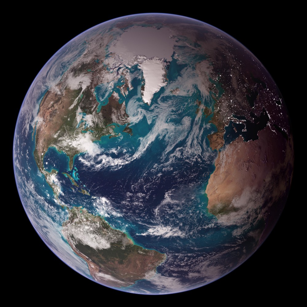


No one on this planet had ever seen a whole picture of the Earth until 1972.
Like this one.
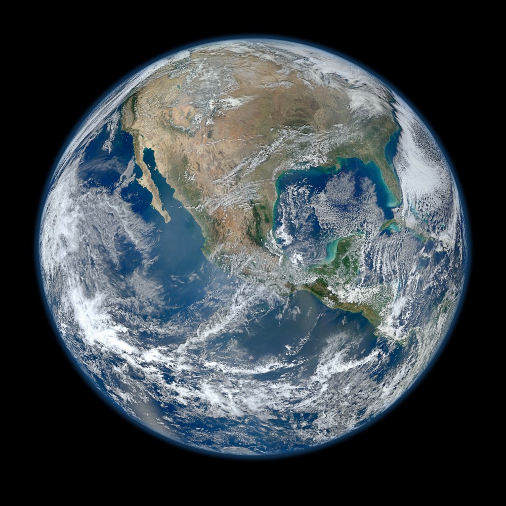
And this one.
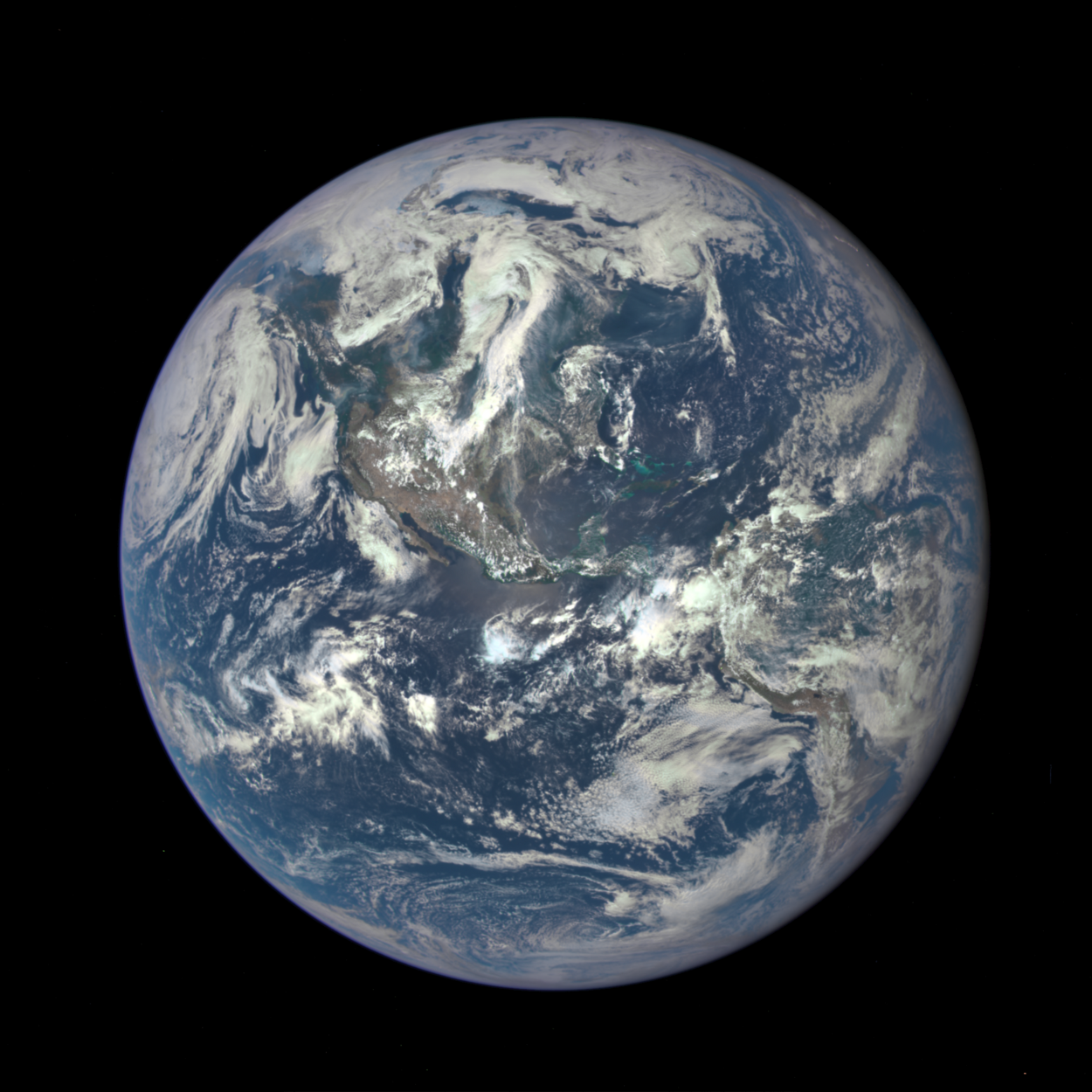
And this one.
So why is the “Blue Marble” a bigger deal than these? Turns out, it’s quite tricky to take a good photo of the entire Earth.
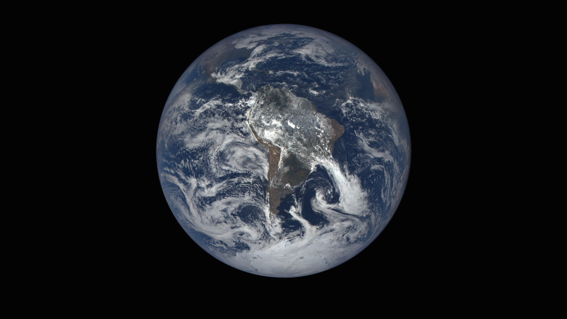
This Blue Marble is the first fully illuminated snapshot of the Earth captured by the DSCOVR satellite,
Funny how North America/AmericaUSA in the middle earth image, is much larger than the earth from the top and bottom images. And people will believe these images, as an actual photo of the earth out in space.
And i mentioned people have trouble perceiving distances and speeds, i can add to that, also difficulty in perceiving size discrepancies,inconsistencies
That's funny.... The fact that the size of the ball of the earth....in comparison to the size of the continents changes...is way different than the perspective of the rope in your picture.That rope is GIGUNDUS!!!

Wow, dude, so.... You are unfamiliar with the concept of perspective?
Seriously? You have NO problem with the north American continent changing sizes in these photos?No one on this planet had ever seen a whole picture of the Earth until 1972.
We knew we lived on it, and had a vast amount of useful information about its makeup, its processes, and its place in the solar system. At the time, some of the most insightful individuals had begun to understand that we, the people who live on Earth, actually had the ability to influence the processes taking place on our planet.
But it was hard for many people to grasp this concept. It seemed abstract, distant, hard to visualize.
Enter “Blue Marble”:
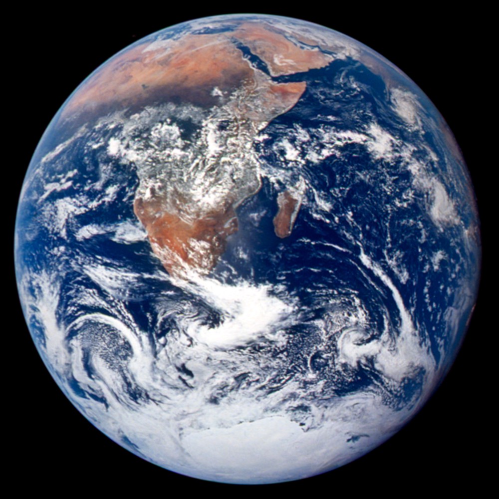
It was the first full photo of the Earth, taken on December 7, 1972, by the American crew of the Apollo 17 spacecraft. The original Blue Marble is thought by many to be the most-reproduced image of all time.
What made the Blue Marble so special? Sure, it might have been the first full photo of the Earth that we took, but we’ve taken a bunch more since then.
Like this one.
And this one.
And this one.
So why is the “Blue Marble” a bigger deal than these? Turns out, it’s quite tricky to take a good photo of the entire Earth.
The first challenge is that our planet is big. The only way to view all of it at once is to get much farther away from the Earth than we do for many of our activities in outer space. The International Space Station, for instance, orbits at a height of just 400 kilometers, or about 249 miles away from Earth.
The second problem is a familiar one that plagues many photographers who are Earthbound: lighting. In order to view the Earth as a fully illuminated globe, a person (or camera) must be situated in front of it, with the sun directly at his or her back. Not surprisingly, it can be difficult to arrange this specific lighting scheme for a camera-set up that’s orbiting in space at speeds approaching thousands of miles per hour.
As a result of these challenges, NASA, NOAA, and other science agencies most often rely on composite images to depict our planet. These images stitch together multiple high-resolution snapshots taken by satellites already in orbit to produce one seamless portrait of the Earth. And that’s what the three photos above are: composite images produced by NASA over the past fifteen years (released respectively in 2002, 2007, and 2012).
Composite imaging is an extremely useful tool for helping people understand the Earth — they allow researchers to capture certain features at higher resolution; reduce the obscuring effect of cloud coverage in certain areas; and overlay various data layers to help identify patterns and trends. Composites can result in some truly remarkable images, like this “Black Marble,” which, by stitching together multiple views of the planet, shows a full global view of the Earth’s city lights.
But there’s something remarkable about a single snapshot of the Earth — an intact view of our planet in its entirety, hanging in space.
Apollo 17 astronaut Eugene Cernan explained:
“…you’re looking at the most beautiful star in the heavens — the most beautiful because it’s the one we understand and we know, it’s home, it’s people, family, love, life — and besides that it is beautiful. You can see from pole to pole and across oceans and continents and you can watch it turn and there’s no strings holding it up, and it’s moving in a blackness that is almost beyond conception.”
That’s why today, I am excited to see that NASA has released its new Blue Marble, the first of many more to come later this year.
This Blue Marble is the first fully illuminated snapshot of the Earth captured by the DSCOVR satellite, a joint NASA, NOAA, and U.S. Air Force mission. After launching in February 2015, DSCOVR spent months rocketing away from Earth before reaching its final orbit position in June 2015 at Lagrange point 1 (L1), about one million miles away from Earth. (A Lagrange point, in case you were wondering, is “a position where the gravitational pull of two large masses precisely equals the centripetal force required for a small object to move with them.” For our purposes, that means that a Lagrange point is a spot at which a satellite can maintain a fixed position relative to the Earth.)
DSCOVR just after launch.
The DSCOVR mission serves several important purposes, including providing scientific data on heat and radiation fluxes across the Earth’s atmosphere, and maintaining the nation’s ability to provide timely alerts and forecasts for space weather events, which can disrupt telecommunications capabilities, power grids, GPS applications, and other systems vital to our daily lives and national and local economies.
And with its Earth Polychromatic Imaging Camera (which has an epic acronym. Seriously. It’s EPIC), DSCOVR will capture and transmit full images of the Earth every few hours! The information gathered by EPIC will help us examine a range of Earth properties, such as ozone and aerosol levels, cloud coverage, and vegetation density, supporting a number of climate science applications.
One of the best parts of this mission is that NASA will make all of the data, data products, and images collected by DSCOVR freely available to the public, including the new “Blue Marble” images. Starting soon, you’ll be able to view and download new “Blue Marble” images taken by DSCOVR every day.
In addition to providing useful data to scientists and researchers, these images will remind all of us that we live on a planet, in a solar system, in a universe. And that we are not just Americans, but citizens of Earth.
Funny how North America/AmericaUSA in the middle earth image, is much larger than the earth from the top and bottom images. And people will believe these images, as an actual photo of the earth out in space.
That rope is GIGUNDUS!!!
Wow, dude, so.... You are unfamiliar with the concept of perspective?
Why can Canada and the top of the globe still be seen in your large photo.Yes ... I see it now. Takes a moment ...
I suggest that you try looking at a typically globe-sized sphere at different distances to really see this effect.Why can Canada and the top of the globe still be seen in your large photo.
Not as many volumes as the fact that you still don't understand perspective.That's funny.... The fact that the size of the ball of the earth....in comparison to the size of the continents changes...is way different than the perspective of the rope in your picture.
The fact that you don't see this... speaks volumes.